MyTopo
Alexandria Indiana US Topo Map
Couldn't load pickup availability
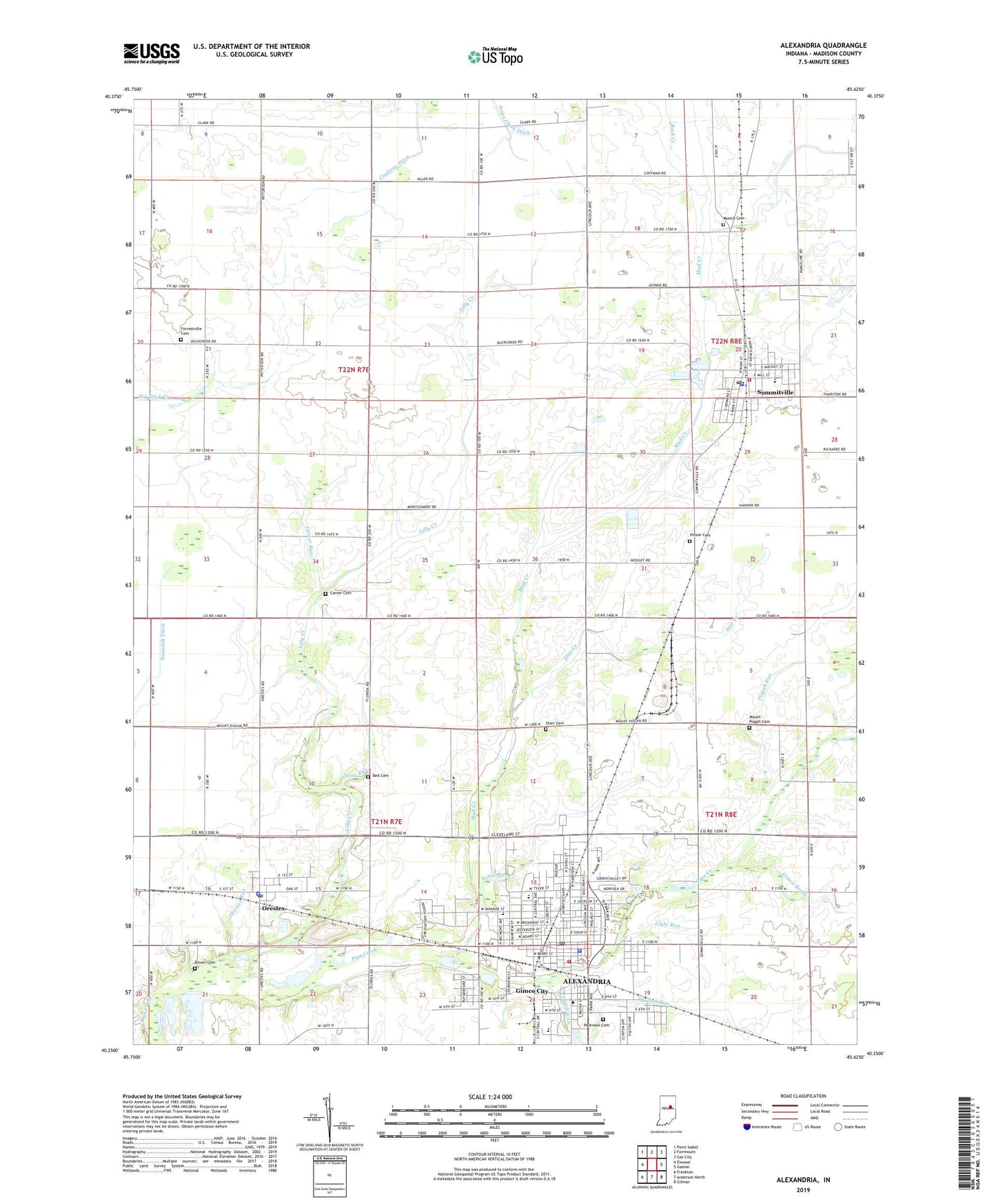
2022 topographic map quadrangle Alexandria in the state of Indiana. Scale: 1:24000. Based on the newly updated USGS 7.5' US Topo map series, this map is in the following counties: Madison. The map contains contour data, water features, and other items you are used to seeing on USGS maps, but also has updated roads and other features. This is the next generation of topographic maps. Printed on high-quality waterproof paper with UV fade-resistant inks.
Quads adjacent to this one:
West: Elwood
Northwest: Point Isabel
North: Fairmount
Northeast: Gas City
East: Gaston
Southeast: Gilman
South: Anderson North
Southwest: Frankton
This map covers the same area as the classic USGS quad with code o40085c6.
Contains the following named places: Alexandria, Alexandria Creek, Alexandria Elementary School, Alexandria Fire Department, Alexandria Police Department, Alexandria Post Office, Bell Cemetery, Beulah Park, Beulah Run, Brown Cemetery, Carver Cemetery, Carver Run, City of Alexandria, Coahran Ditch, Cunningham Elementary School, Dong Run, Forrestville Cemetery, Gimco Brook, Gimco City, Hasty Ditch, Jones Clark Ditch, Light Run, Lilly Creek, Lilly Creek Church, Limit Run, Mount Pisgah Cemetery, Mud Creek, Musick Cemetery, Orestes, Orestes Elementary School, Orestes Police Department, Orestes Post Office, Orestes Run, Parkview Cemetery, Pisgah Run, Saint Marys School, Star Creek, Starr Cemetery, Summitville, Summitville Fire Department, Summitville Police Department, Summitville Post Office, Town of Orestes, Town of Summitville, Township of Boone, Township of Monroe, Union Chapel, Union Church, Vinson Cemetery, Vinson Drain, ZIP Codes: 46001, 46063, 46070