MyTopo
Gilman Indiana US Topo Map
Couldn't load pickup availability
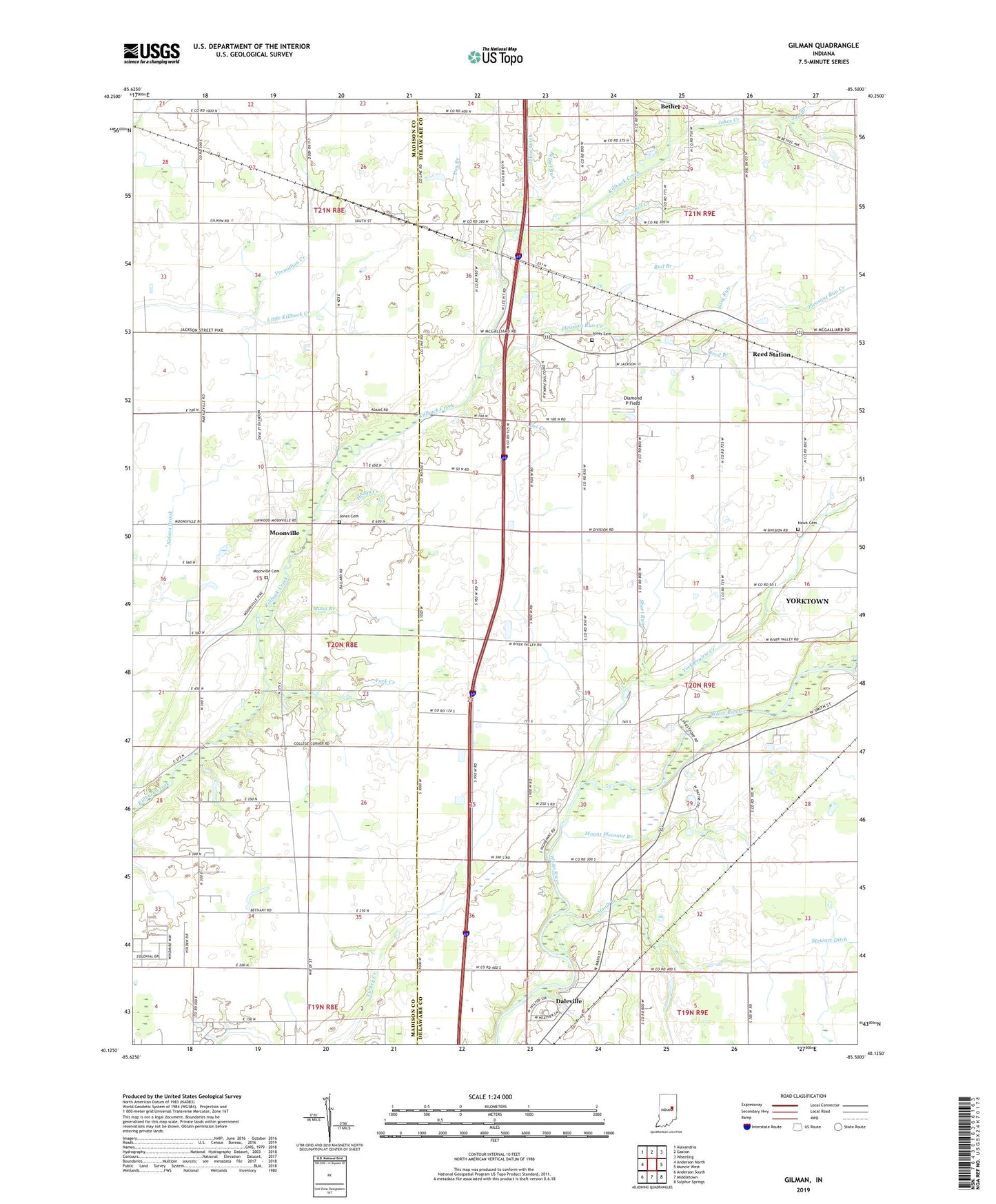
2022 topographic map quadrangle Gilman in the state of Indiana. Scale: 1:24000. Based on the newly updated USGS 7.5' US Topo map series, this map is in the following counties: Delaware, Madison. The map contains contour data, water features, and other items you are used to seeing on USGS maps, but also has updated roads and other features. This is the next generation of topographic maps. Printed on high-quality waterproof paper with UV fade-resistant inks.
Quads adjacent to this one:
West: Anderson North
Northwest: Alexandria
North: Gaston
Northeast: Wheeling
East: Muncie West
Southeast: Sulphur Springs
South: Middletown
Southwest: Anderson South
This map covers the same area as the classic USGS quad with code o40085b5.
Contains the following named places: Bethel Run, Buck Creek, Del Creek, Diamond P Field, Dry Branch, Easy Run, Fork Creek, Gilman, Hawk Cemetery, Heagy Creek, Hofherr Chapel, Jakes Creek, Jay Branch, Johns Ditch, Jones Cemetery, Jones Run, Kill Creek, Moon Branch, Moonville, Moonville Cemetery, Mount Pleasant Branch, Mount Pleasant Church, Pikes Peak Church, Pleasant Run Church, Pleasant Run Creek, Pond Branch, Rail Branch, Reed Branch, Reed Run, Reed Station, Short Run, Stewart Ditch, Town of Yorktown, Township of Mount Pleasant, Township of Richland, Vermillion Church, Vermillion Creek, Vermillion Meetinghouse, Water Run, York Prairie Creek, ZIP Codes: 46012, 47396