MyTopo
Bicknell Indiana US Topo Map
Couldn't load pickup availability
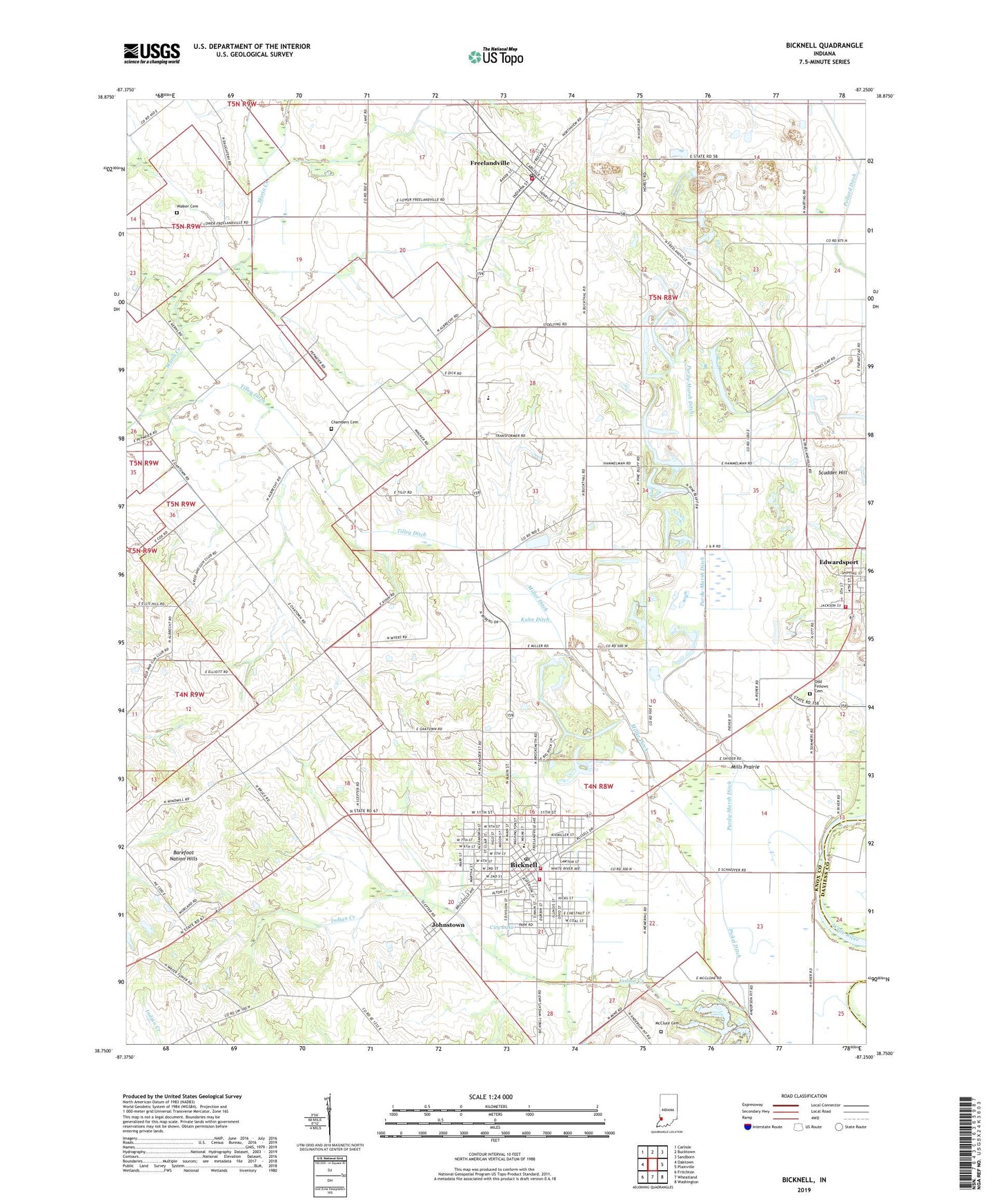
2022 topographic map quadrangle Bicknell in the state of Indiana. Scale: 1:24000. Based on the newly updated USGS 7.5' US Topo map series, this map is in the following counties: Knox, Daviess. The map contains contour data, water features, and other items you are used to seeing on USGS maps, but also has updated roads and other features. This is the next generation of topographic maps. Printed on high-quality waterproof paper with UV fade-resistant inks.
Quads adjacent to this one:
West: Oaktown
Northwest: Carlisle
North: Bucktown
Northeast: Sandborn
East: Plainville
Southeast: Washington
South: Wheatland
Southwest: Fritchton
This map covers the same area as the classic USGS quad with code o38087g3.
Contains the following named places: Barefoot Nation Hills, Bethel Church, Bicknell, Bicknell Country Club, Bicknell Fire Department, Bicknell Post Office, Bicknell Vigo Township Fire Department, Bicknell Volunteer Fire Department, Chambers Cemetery, City Lake, City of Bicknell, Edwardsport, Edwardsport Volunteer Fire Department, Fore and Atkinson Levee, Freelandville, Freelandville Census Designated Place, Freelandville Post Office, Freelandville Volunteer Fire Department, Hooper Athletic Field, Johnstown, Knox County Emergency Medical Services Bicknell, Kuhn Ditch, McClure Cemetery, Miller Ditch, Mills Prairie, North Knox Central Elementary School, North Knox East Elementary and Junior High School, North Knox High School, Odd Fellows Cemetery, Pickel Ditch, Purdy-Marsh Ditch, Scudder Hill, Tilley Ditch, Town of Edwardsport, Township of Widner, Vigo Township Volunteer Fire Department, Walker Cemetery, ZIP Codes: 47512, 47528, 47535