MyTopo
Wheatland Indiana US Topo Map
Couldn't load pickup availability
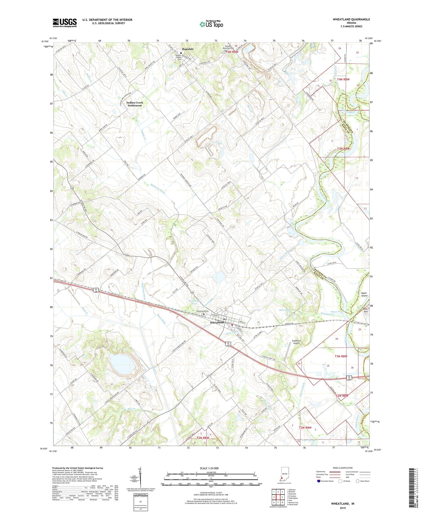
2022 topographic map quadrangle Wheatland in the state of Indiana. Scale: 1:24000. Based on the newly updated USGS 7.5' US Topo map series, this map is in the following counties: Knox, Daviess. The map contains contour data, water features, and other items you are used to seeing on USGS maps, but also has updated roads and other features. This is the next generation of topographic maps. Printed on high-quality waterproof paper with UV fade-resistant inks.
Quads adjacent to this one:
West: Fritchton
Northwest: Oaktown
North: Bicknell
Northeast: Plainville
East: Washington
Southeast: Sandy Hook
South: Monroe City
Southwest: Iona
This map covers the same area as the classic USGS quad with code o38087f3.
Contains the following named places: Asbury Chapel, Asbury Chapel Cemetery, Bennington Levee, Bens Creek, Bicknell Memorial Cemetery, Flat Creek, Ghost Hollow Creek, Godahavit Airport, Hyatt Island, Indian Creek, Indian Creek Settlement, Kessinger Ditch, Mine Pond, Montours Pond, Nicholson Pond, Nimnicht Creek, Opossum Branch, Ragsdale, Ragsdale Census Designated Place, Reel Creek, Roberson Ditch, Steen Ditch, Steen Township Volunteer Fire Department, Storks Ferry, Toms Hill, Town of Wheatland, Township of Steen, Weaver Pond, Wheatland, Wheatland Cemetery, Wheatland Post Office, ZIP Code: 47597