MyTopo
Fairmount Indiana US Topo Map
Couldn't load pickup availability
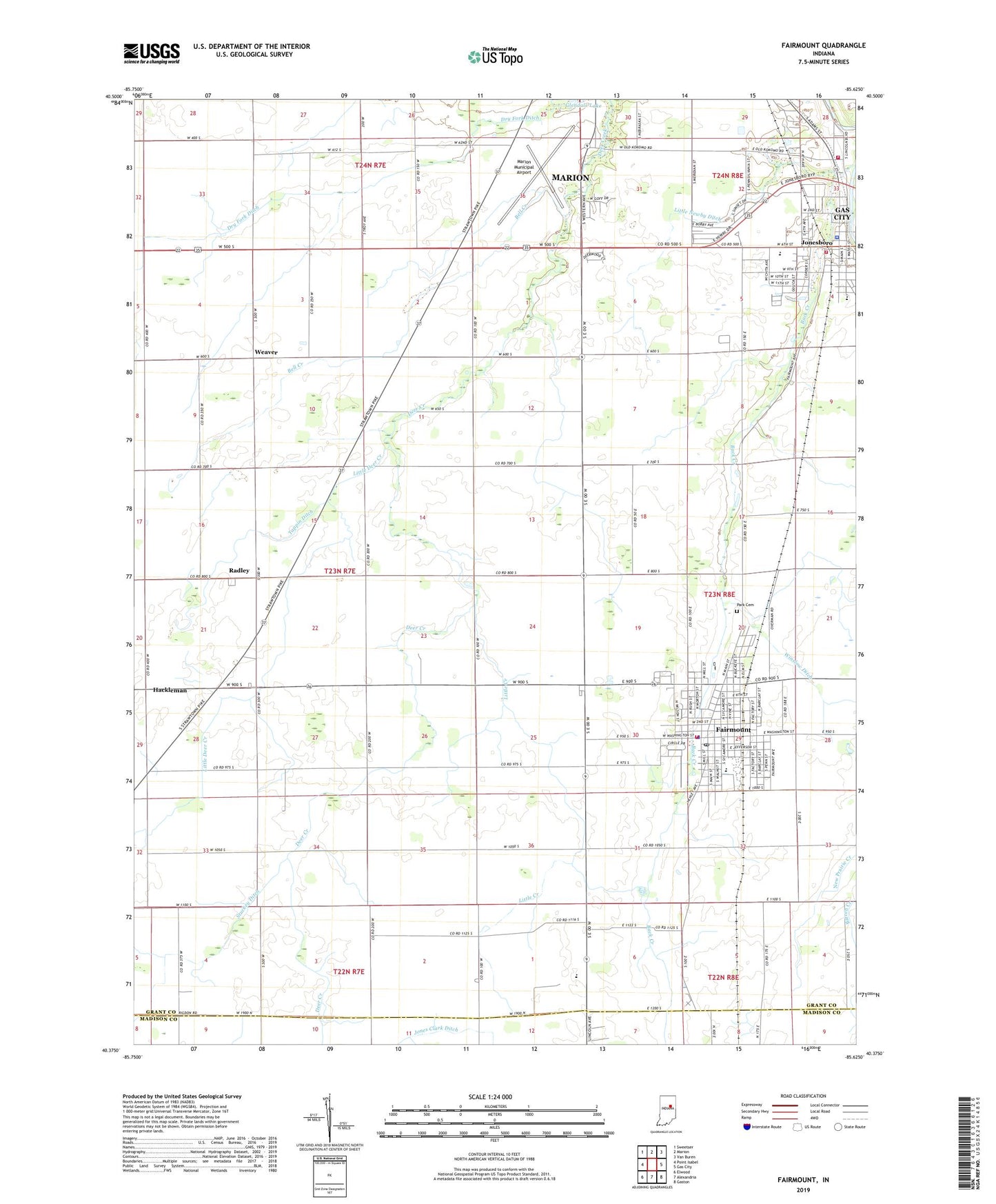
2022 topographic map quadrangle Fairmount in the state of Indiana. Scale: 1:24000. Based on the newly updated USGS 7.5' US Topo map series, this map is in the following counties: Grant, Madison. The map contains contour data, water features, and other items you are used to seeing on USGS maps, but also has updated roads and other features. This is the next generation of topographic maps. Printed on high-quality waterproof paper with UV fade-resistant inks.
Quads adjacent to this one:
West: Point Isabel
Northwest: Sweetser
North: Marion
Northeast: Van Buren
East: Gas City
Southeast: Gaston
South: Alexandria
Southwest: Elwood
This map covers the same area as the classic USGS quad with code o40085d6.
Contains the following named places: Back Creek, Back Creek Church, Barren Creek, Bell Creek, Bethel Church, Center Church, City of Jonesboro, Dry Fork Ditch, Fairmount, Fairmount Fire Department, Fairmount Middle School, Fairmount Police Department, Fairmount Post Office, Glendale Lake, Grant County Emergency Medical Services - Fairmount Medic 7, Hackleman, Hill Chapel, J C Knight Elementary School, Jonesboro, Jonesboro Police Department, Jonesboro Volunteer Fire Department, Little Creek, Little Deer Creek, Little Newby Ditch, Little Ridge Church, Marion Municipal Airport, Mill Township Volunteer Fire Department, Oak Ridge Church, Park Cemetery, Park Elementary School, Peacock Farms Airport, Radley, Radley Church, Stuckey Ditch, Tappin Ditch, Town of Fairmount, Township of Liberty, Weaver, Westview Elementary School, Winslow Ditch, ZIP Codes: 46928, 46938