MyTopo
Michigantown Indiana US Topo Map
Couldn't load pickup availability
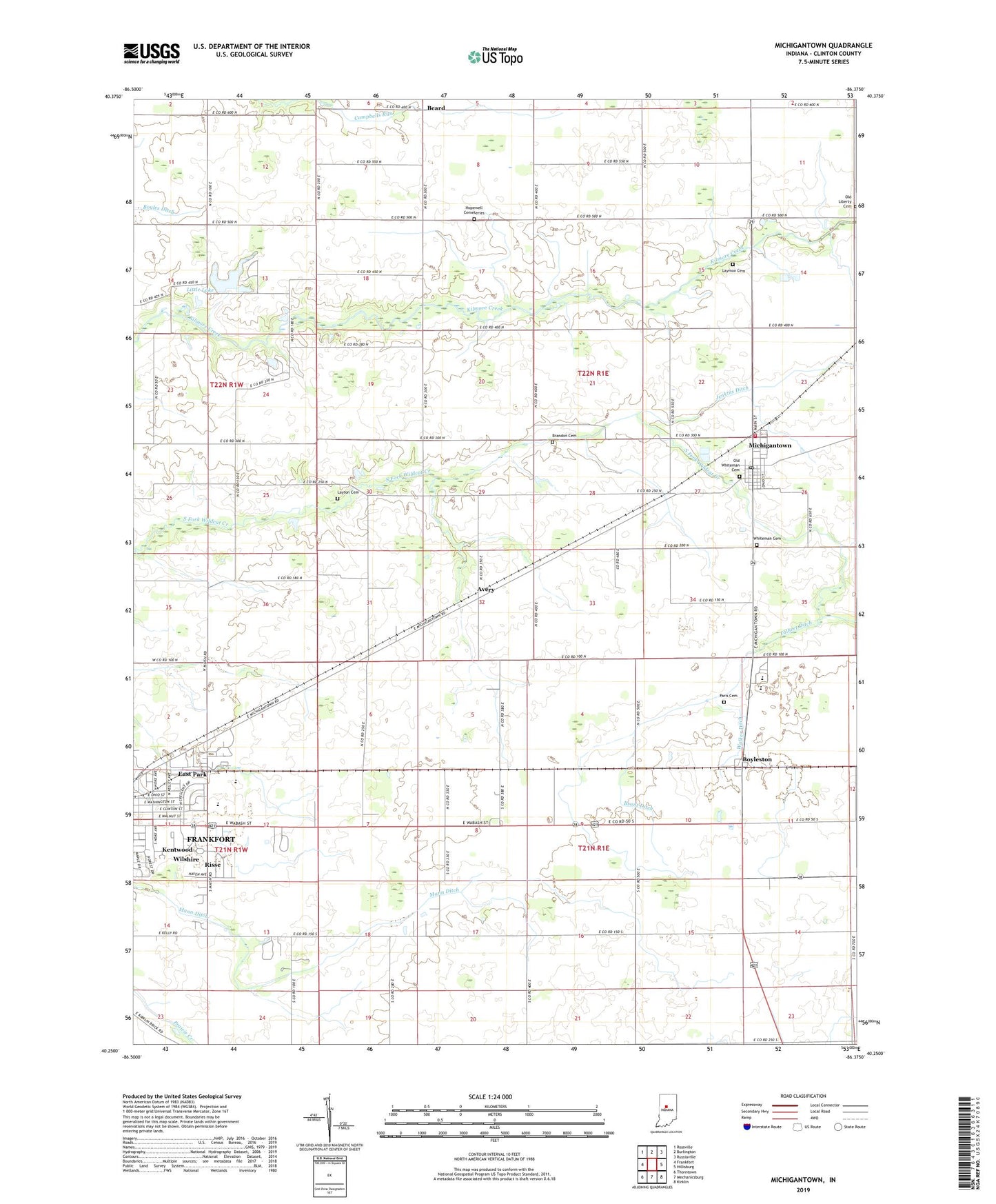
2022 topographic map quadrangle Michigantown in the state of Indiana. Scale: 1:24000. Based on the newly updated USGS 7.5' US Topo map series, this map is in the following counties: Clinton. The map contains contour data, water features, and other items you are used to seeing on USGS maps, but also has updated roads and other features. This is the next generation of topographic maps. Printed on high-quality waterproof paper with UV fade-resistant inks.
Quads adjacent to this one:
West: Frankfort
Northwest: Rossville
North: Burlington
Northeast: Russiaville
East: Hillisburg
Southeast: Kirklin
South: Mechanicsburg
Southwest: Thorntown
This map covers the same area as the classic USGS quad with code o40086c4.
Contains the following named places: Avery, Beard, Boyleston, Brandon Cemetery, Brant Ditch, Clinton Central Elementary School, Clinton Central High School, Clinton County, East Park, Hopewell Cemeteries, Hopewell Church, Jenkins Ditch, Kentwood, Laymon Cemetery, Layton Cemetery, Little Lake, Little Lakes Estates Dam, Mann Ditch, Michigan Township Volunteer Fire Department, Michigantown, Michigantown Post Office, Old Liberty Cemetery, Old Whiteman Cemetery, Paris Cemetery, Risse, Talbert Ditch, Town of Michigantown, Township of Center, Township of Michigan, Walker Ditch, Whiteman Cemetery, Wilshire, ZIP Codes: 46041, 46057