MyTopo
Wheeling Indiana US Topo Map
Couldn't load pickup availability
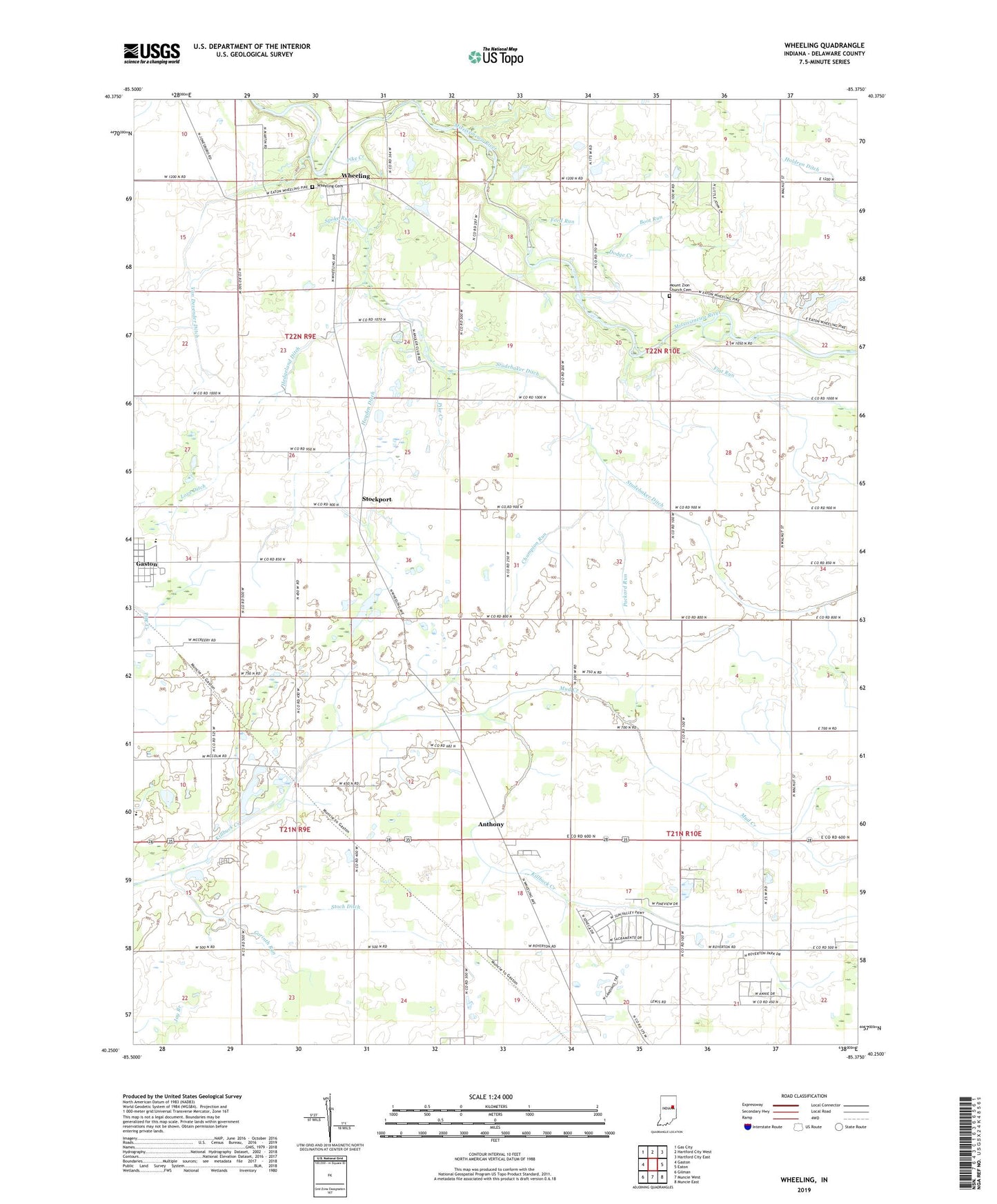
2022 topographic map quadrangle Wheeling in the state of Indiana. Scale: 1:24000. Based on the newly updated USGS 7.5' US Topo map series, this map is in the following counties: Delaware. The map contains contour data, water features, and other items you are used to seeing on USGS maps, but also has updated roads and other features. This is the next generation of topographic maps. Printed on high-quality waterproof paper with UV fade-resistant inks.
Quads adjacent to this one:
West: Gaston
Northwest: Gas City
North: Hartford City West
Northeast: Hartford City East
East: Eaton
Southeast: Muncie East
South: Muncie West
Southwest: Gilman
This map covers the same area as the classic USGS quad with code o40085c4.
Contains the following named places: Anthony, Austin Run, Boot Run, Branson Ditch, Center Chapel, Champion Run, Corinth Church, Corinth Run, Dodge Creek, Flat Run, Ford Run, Gaston Elementary School, Harrison Elementary School, Hayden Ditch, Hedgeland Ditch, Love Ditch, Mount Zion Church Cemetery, Mud Creek, Olive Chapel, Packard Run, Path Run, Pike Creek, Rim Run, Spoke Run, Stoch Ditch, Stockport, Studebaker Ditch, Township of Hamilton, Township of Union, Trail Run, Union Grove Church, Van Devender Ditch, Wes-Del Senior High School, Wheeling, Wheeling Cemetery, ZIP Code: 47303