MyTopo
Monroe City Indiana US Topo Map
Couldn't load pickup availability
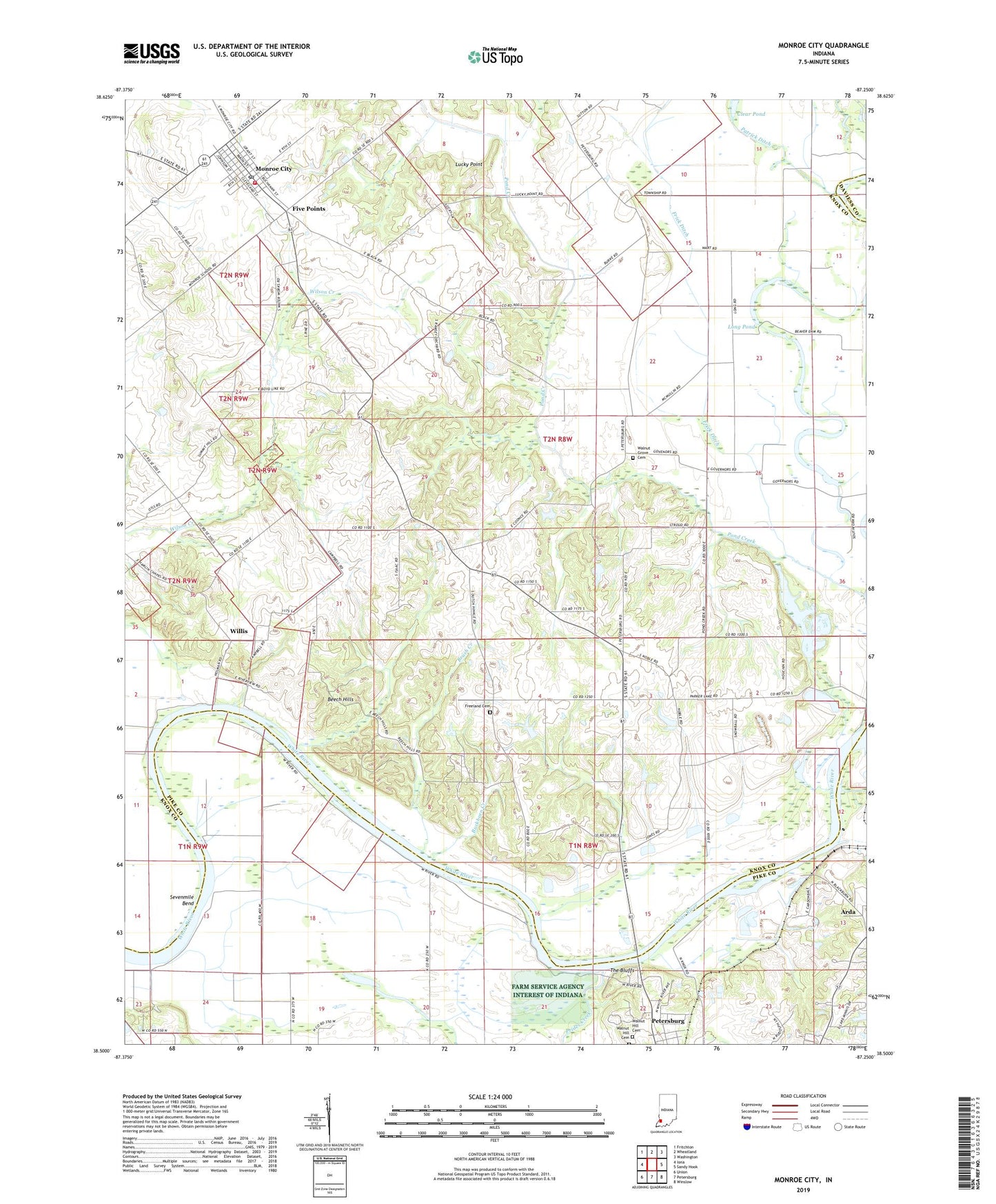
2022 topographic map quadrangle Monroe City in the state of Indiana. Scale: 1:24000. Based on the newly updated USGS 7.5' US Topo map series, this map is in the following counties: Knox, Pike, Daviess. The map contains contour data, water features, and other items you are used to seeing on USGS maps, but also has updated roads and other features. This is the next generation of topographic maps. Printed on high-quality waterproof paper with UV fade-resistant inks.
Quads adjacent to this one:
West: Iona
Northwest: Fritchton
North: Wheatland
Northeast: Washington
East: Sandy Hook
Southeast: Winslow
South: Petersburg
Southwest: Union
This map covers the same area as the classic USGS quad with code o38087e3.
Contains the following named places: Arda, Bartons Location, Beech Hills, Brush Creek, Buckhorn Creek, Clear Pond, Farm Service Agency Interest of Indiana, Five Points, Freeland Cemetery, Frick Ditch, Hamline Chapel, Harrison Township Volunteer Fire Department, Lick Creek, Long Pond, Lucky Point, Monroe City, Monroe City Post Office, Patrick Ditch, Pond Creek Mills, Prides Creek, Sevenmile Bend, South Knox Elementary School, The Bluffs, Town of Monroe City, Township of Harrison, Walnut Grove Cemetery, Walnut Grove Church, Walnut Hill Cemetery, Warner Lake, Whiteriver Airfield, Willis, Wilson Creek Church, Wrights Ferry, ZIP Code: 47557