MyTopo
Kempton Indiana US Topo Map
Couldn't load pickup availability
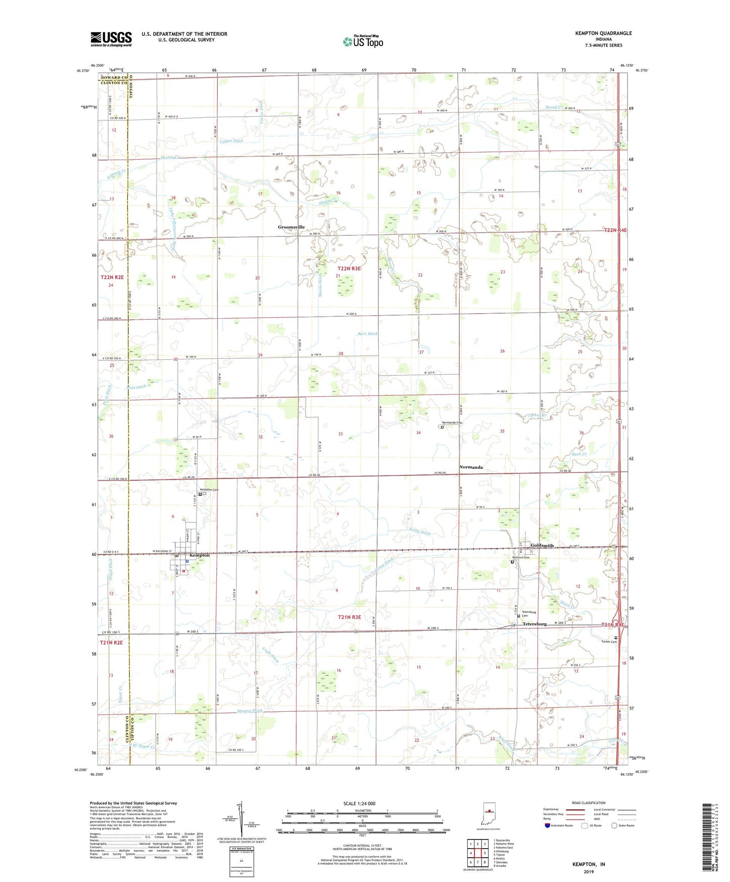
2022 topographic map quadrangle Kempton in the state of Indiana. Scale: 1:24000. Based on the newly updated USGS 7.5' US Topo map series, this map is in the following counties: Tipton, Clinton, Howard. The map contains contour data, water features, and other items you are used to seeing on USGS maps, but also has updated roads and other features. This is the next generation of topographic maps. Printed on high-quality waterproof paper with UV fade-resistant inks.
Quads adjacent to this one:
West: Hillisburg
Northwest: Russiaville
North: Kokomo West
Northeast: Kokomo East
East: Tipton
Southeast: Arcadia
South: Sheridan
Southwest: Kirklin
This map covers the same area as the classic USGS quad with code o40086c2.
Contains the following named places: Barr Ditch, Bethel Church, Broad Creek, Carter Ditch, Collier Ditch, Cox Ditch, Crum Ditch, Fernung Farms, Floyd Ditch, Goldsmith, Groomsville, Hopewell Church, Kemp Ditch, Kempton, Kempton Cemetery, Kempton Fire and Rescue Department, Kempton Police Department, Kempton Post Office, Kigin Ditch, Liberty Church, Lydy-Fillenworth Ditch, Magnet Ditch, Mott Ditch, Mount Lebanon Church, Mount Olive Church, Normanda, Normanda Cemetery, R Hog Farm, Shanty Creek, Tetersburg, Tetersburg Cemetery, Town of Kempton, Township of Jefferson, Township of Prairie, Tucker Cemetery, Wolford Cemetery, Yazel Ditch, ZIP Codes: 46045, 46049