MyTopo
Hillisburg Indiana US Topo Map
Couldn't load pickup availability
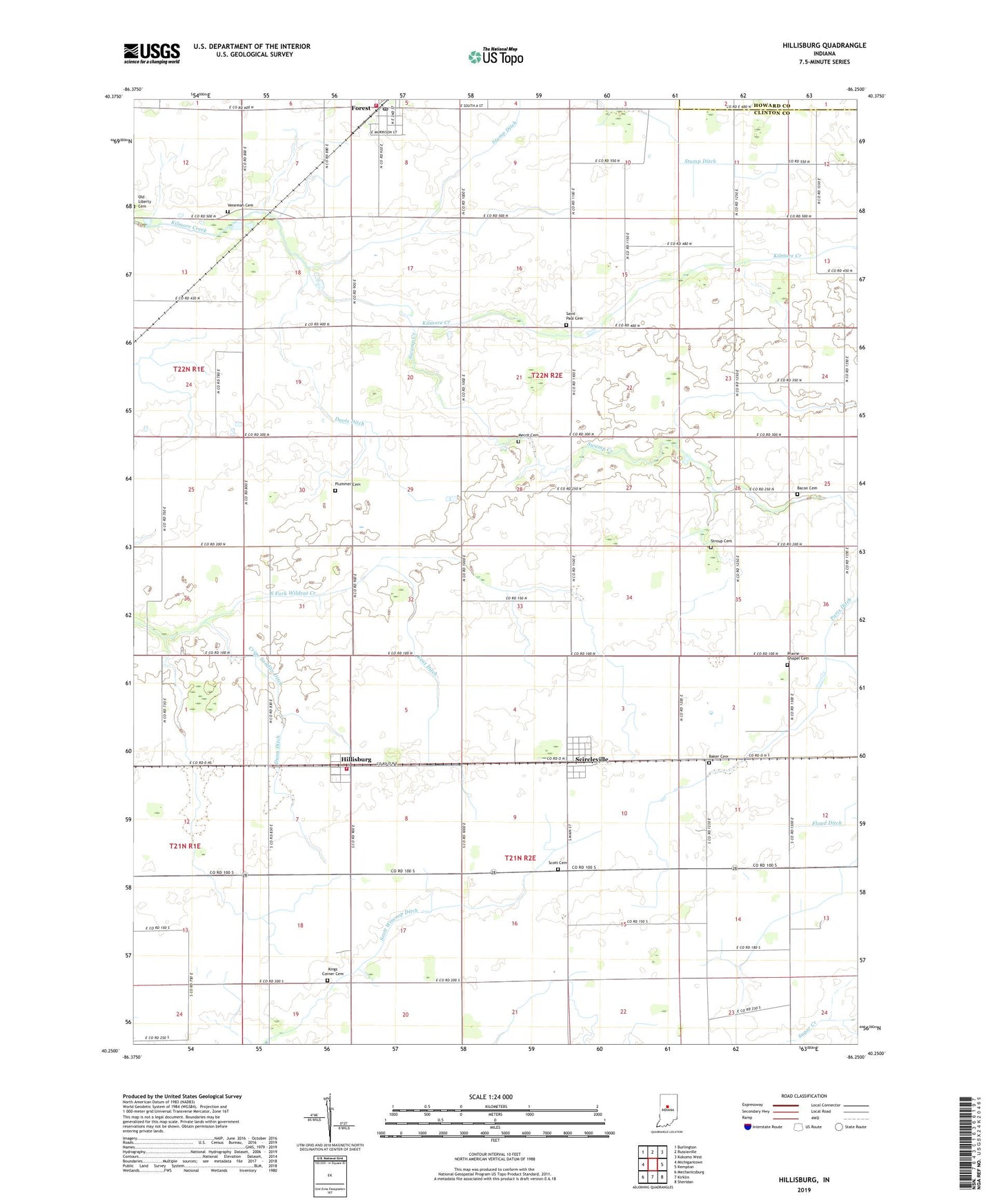
2022 topographic map quadrangle Hillisburg in the state of Indiana. Scale: 1:24000. Based on the newly updated USGS 7.5' US Topo map series, this map is in the following counties: Clinton, Howard. The map contains contour data, water features, and other items you are used to seeing on USGS maps, but also has updated roads and other features. This is the next generation of topographic maps. Printed on high-quality waterproof paper with UV fade-resistant inks.
Quads adjacent to this one:
West: Michigantown
Northwest: Burlington
North: Russiaville
Northeast: Kokomo West
East: Kempton
Southeast: Sheridan
South: Kirklin
Southwest: Mechanicsburg
This map covers the same area as the classic USGS quad with code o40086c3.
Contains the following named places: Bacon Cemetery, Baker Cemetery, Cripe Sandlin Ditch, Davis Ditch, Dunn Ditch, Forest, Forest Fire Department, Forest Post Office, Hillisburg, Johnson Township Volunteer Fire Department, Kent Ditch, Kings Corner Cemetery, Merrit Cemetery, Paris Ditch, Plummer Cemetery, Prairie Chapel Cemetery, Saint Paul Cemetery, Scircleville, Scott Cemetery, Scott Wincorp Ditch, South Branch Sugar Creek, Stroup Cemetery, Stump Ditch, Swamp Creek, Township of Forest, Township of Johnson, Veneman Cemetery, ZIP Code: 46039