MyTopo
Muncie West Indiana US Topo Map
Couldn't load pickup availability
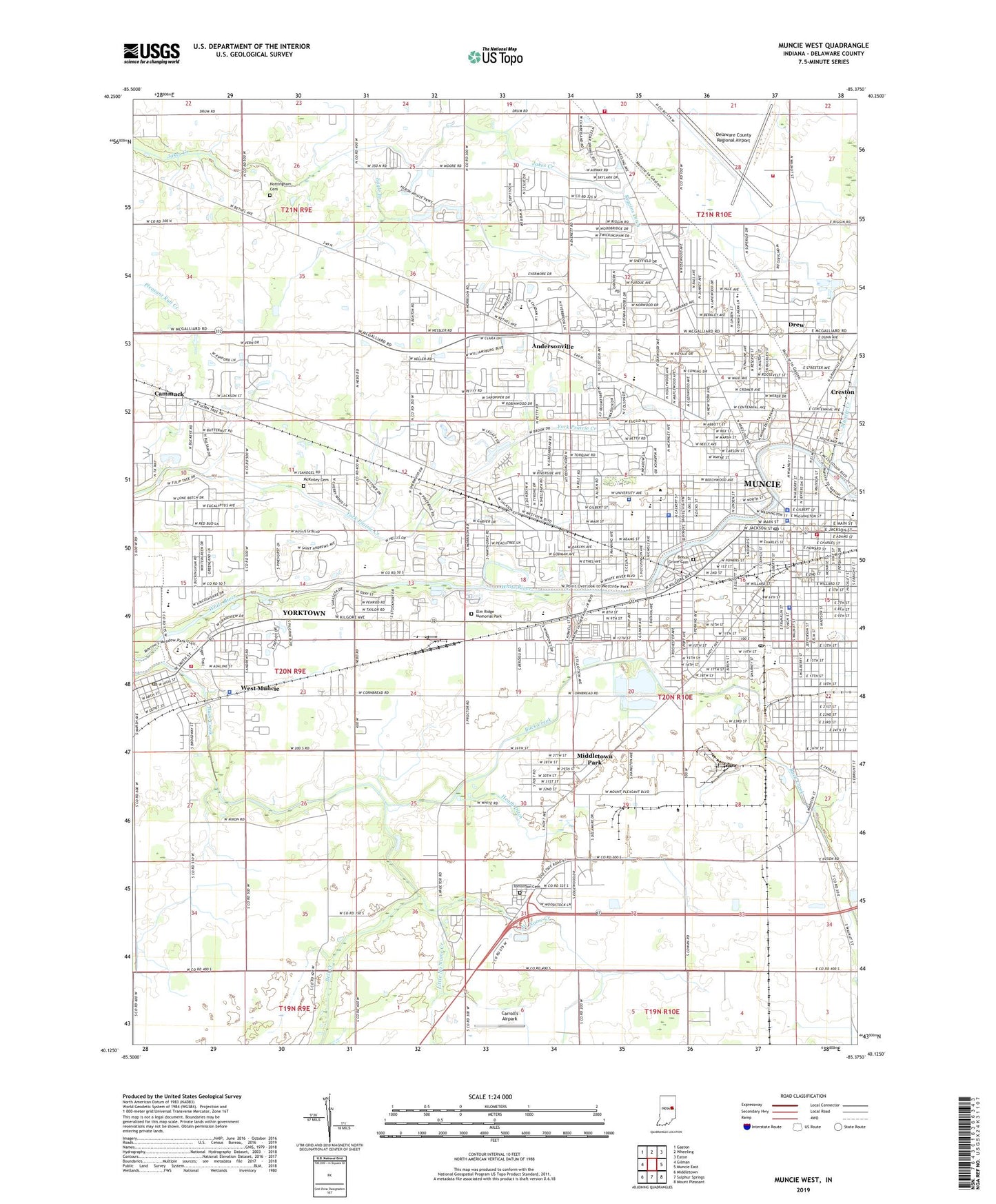
2022 topographic map quadrangle Muncie West in the state of Indiana. Scale: 1:24000. Based on the newly updated USGS 7.5' US Topo map series, this map is in the following counties: Delaware. The map contains contour data, water features, and other items you are used to seeing on USGS maps, but also has updated roads and other features. This is the next generation of topographic maps. Printed on high-quality waterproof paper with UV fade-resistant inks.
Quads adjacent to this one:
West: Gilman
Northwest: Gaston
North: Wheeling
Northeast: Eaton
East: Muncie East
Southeast: Mount Pleasant
South: Sulphur Springs
Southwest: Middletown
This map covers the same area as the classic USGS quad with code o40085b4.
Contains the following named places: Andersonville, Anthony Elementary School, Antioch Church, Ball State University, Ball State University Police Department, Beech Grove Cemetery, Bell Creek, Bradford Park, Burris School, Cammack, Carroll's Airpark, Center Township Emergency Services Station 12, Center Township Emergency Services Station 13, Central High School, City of Muncie, Corinth Church, Cowing Park, Delaware County, Delaware County Airport Authority Fire Department, Delaware County Emergency Medical Services, Delaware County Regional Airport, Delaware County Sheriff's Office, Downtown Muncie Post Office, Drew, Eagle Branch, Elm Ridge Memorial Park, Emerson School, Field School, Forest Park Elementary School, Garfield Elementary School, Guthrie Park, Harrison School, Heath Ditch, Heekin Park, Indiana University Ball Memorial Hospital, Jefferson School, John B And June M Scheumann Stadium, Lincoln School, Little No Name Creek, McCulloch Park, McKinley Cemetery, McKinley High School, McKinley Middle School, Memorial Church, Meridian Services, Middletown Park, Mitchell Elementary School, Morrison Mock Elementary School, Mount Olive Church, Mount Zion Church, Muncie, Muncie Creek, Muncie Fire Department, Muncie Mall, Muncie Police Department, Muncie Post Office, No Name Creek, North View Elementary School, Northside High School, Northwest Plaza Shopping Center, Nottingham Cemetery, Pleasant View Elementary School, Renaissance Specialty Hospital of Central Indiana, Riggins Ditch, Riley Elementary School, Roosevelt School, Rose Park, Saint Andrews Church, Saint Mary School, Southside Church, Southway Plaza, Storer Middle School, Temple Church, Thomas Park, Tomlinson Cemetery, Township of Center, Tuhey Park, Washington-Carver Community Elementary School, WBST-FM (Muncie), West Muncie, West View Elementary School, Westside Church, Westside Park, Wilson Middle School, WIPB-TV (Muncie), WLBC-AM (Muncie), WLBC-FM (Muncie), WWHI-FM (Muncie), Yorktown, Yorktown Fire Department, Yorktown High School, Yorktown Middle School, Yorktown Police Department, Yorktown Post Office, ZIP Codes: 47302, 47304, 47305, 47306