MyTopo
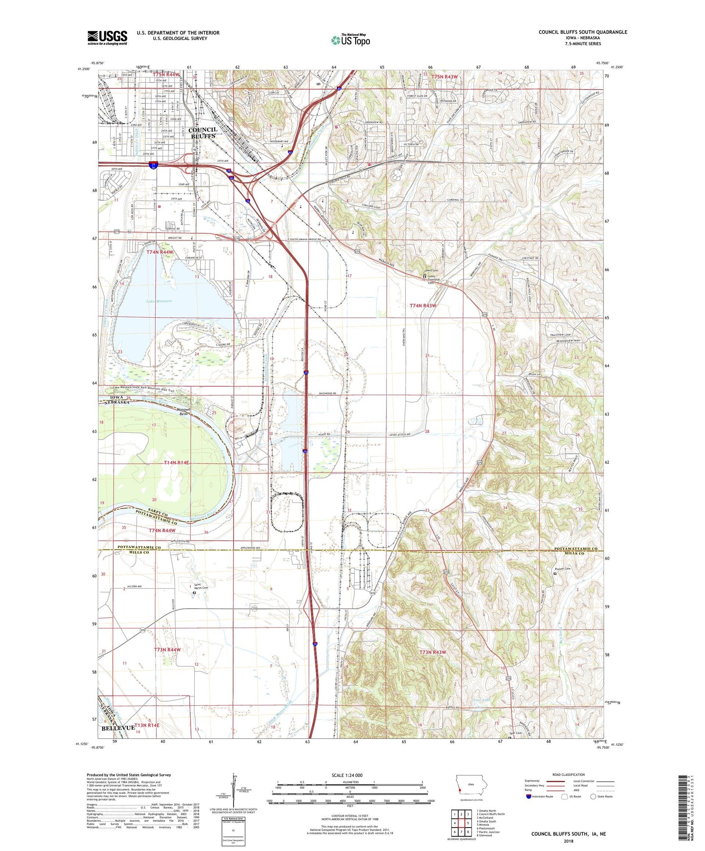
Council Bluffs South Iowa US Topo Map
Couldn't load pickup availability
2022 topographic map quadrangle Council Bluffs South in the state of Iowa. Scale: 1:24000. Based on the newly updated USGS 7.5' US Topo map series, this map is in the following counties: Pottawattamie, Mills, Sarpy. The map contains contour data, water features, and other items you are used to seeing on USGS maps, but also has updated roads and other features. This is the next generation of topographic maps. Printed on high-quality waterproof paper with UV fade-resistant inks.
Quads adjacent to this one:
West: Omaha South
Northwest: Omaha North
North: Council Bluffs North
Northeast: McClelland
East: Mineola
Southeast: Glenwood
South: Pacific Junction
Southwest: Plattsmouth
Contains the following named places: Bethany Presbyterian Church, Bluff Acres Mobile Home Park, Calvary Baptist Church, Carr Lake, City of Council Bluffs, Council Bluffs Drive-In-Theatre, Council Bluffs Fire Department Station 4, Council Bluffs Fire Department Station 5, Council Bluffs Medical Mall, Council Bluffs Police Department, Council Bluffs Post Office, Council Bluffs Sewage Plant, Country Estates Mobile Home Park, Deaf Missions Church, East Side Christian Church, Emanuel Church of the Nazarene, Faith Lutheran Church, First Assembly of God Church, Gethsemane Presbyterian Church, Grand Encampment Marker, Heartland Christian School, Heartland District Pentecostal Church of God, Indian Creek, Indian Creek Ditch, Iowa School for the Deaf, Iowa School of the Deaf Nature Center Trail, Iowa West Foundation Trailhead Park, Island Park, Islandpark Post Office, Jehovahs Witnesses, Kaplan University - Council Bluffs Campus, Lake Manawa, Lake Manawa Post Office, Lake Manawa State Park, Lakeshore Country Club, Lakeview Elementary School, Lewis Cemetery, Lewis Central High School, Lewis Central Middle School, Lewis Township Cemetery, Lewis Township Fire and Rescue, Longfellow Elementary School, Longs Landing County Park, Lutherische Kirche, Madison Shoppes, Mall of the Bluffs, Manawa Bend, Manawa City Park, Manawa Power Centre, Mormon Battalion Marker, Mosquito Creek, Neoga, Neoga Post Office, North Shore Park, Peavey Grain Company Elevator, Peterson Park, Plumer Cemetery, Pusey Elementary School, RailsWest Railroad Museum, Regency of Iowa Mobile Home Park, Ridgecrest Baptist Church, Risen Son Christian Village Center, Saar Cemetery, Saint Marys Cemetery, Saint Marys Ditch, Salem United Methodist Church, Scottswood, Southside Christian Church, Southview Bible Church, Sunset Park, Titan Hill Intermediate School, Tobin Eye Institute, Tomes County Club Acres, Township of Lewis, Traders Point, Tree Lake, Tree Lake Park, Woodbury Hills Shopping Center, Wooded Lake Mobile Home Park, ZIP Code: 51503