MyTopo
Mineola Iowa US Topo Map
Couldn't load pickup availability
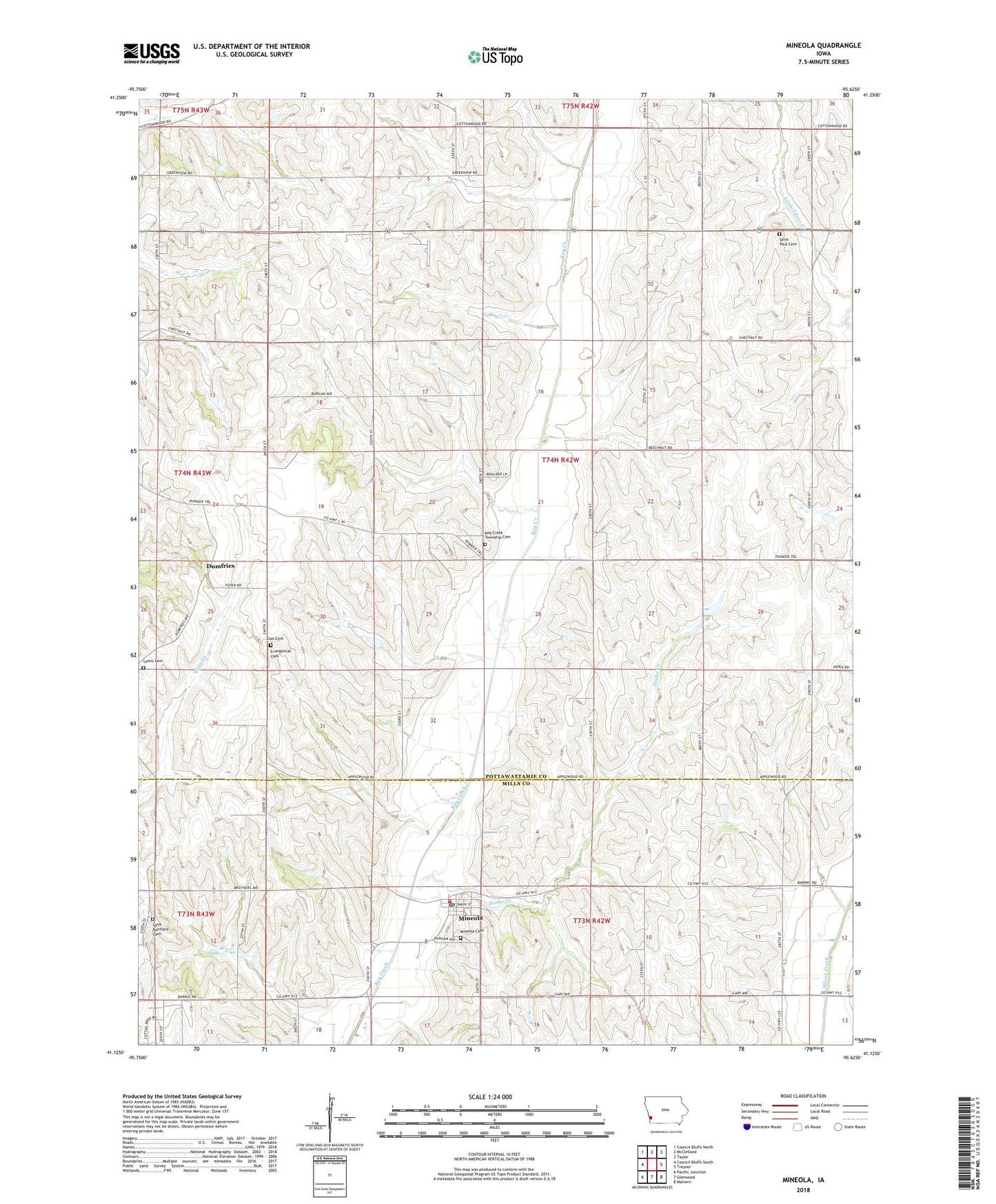
2022 topographic map quadrangle Mineola in the state of Iowa. Scale: 1:24000. Based on the newly updated USGS 7.5' US Topo map series, this map is in the following counties: Pottawattamie, Mills. The map contains contour data, water features, and other items you are used to seeing on USGS maps, but also has updated roads and other features. This is the next generation of topographic maps. Printed on high-quality waterproof paper with UV fade-resistant inks.
Quads adjacent to this one:
West: Council Bluffs South
Northwest: Council Bluffs North
North: McClelland
Northeast: Taylor
East: Treynor
Southeast: Malvern
South: Glenwood
Southwest: Pacific Junction
This map covers the same area as the classic USGS quad with code o41095b6.
Contains the following named places: Dumfries, Dumfries Post Office, Evergreen School, Keg Creek, Keg Creek Post Office, Keg Creek Township Cemetery, Letal School, Mineola, Mineola Cemetery, Mineola Census Designated Place, Mineola Post Office, Oak Township Fire Department, Saint Boniface Cemetery, Saint John Lutheran Church, Saint Paul Church, Saint Paul Lutheran Cemetery, Saint Pauls Evangelical Country Church Cemetery, Snake Creek, Sunnyside School, Township of Keg Creek, Zion Cemetery, ZIP Code: 51554