MyTopo
Pelican Louisiana US Topo Map
Couldn't load pickup availability
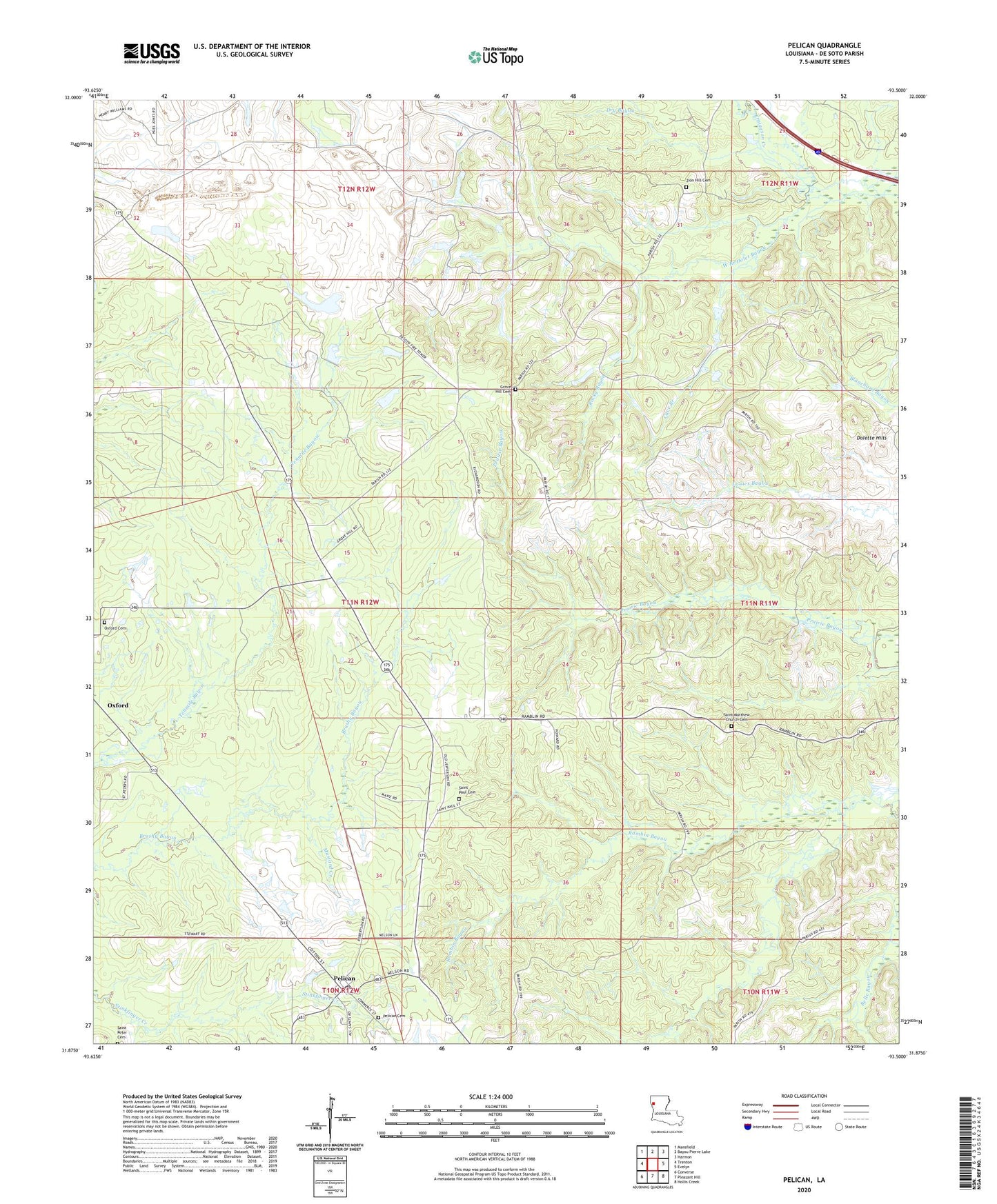
2024 topographic map quadrangle Pelican in the state of Louisiana. Scale: 1:24000. Based on the newly updated USGS 7.5' US Topo map series, this map is in the following counties: De Soto. The map contains contour data, water features, and other items you are used to seeing on USGS maps, but also has updated roads and other features. This is the next generation of topographic maps. Printed on high-quality waterproof paper with UV fade-resistant inks.
Quads adjacent to this one:
West: Trenton
Northwest: Mansfield
North: Bayou Pierre Lake
Northeast: Harmon
East: Evelyn
Southeast: Hollis Creek
South: Pleasant Hill
Southwest: Converse
This map covers the same area as the classic USGS quad with code o31093h5.
Contains the following named places: All Saints-Pelican Elementary School, Cave Branch, DeSoto Lookout Tower, Dolette, Dolette Hills, Dry Bayou, East Trenton Oil Field, Fraigeson Creek, Grove Hill, Grove Hill Church, Mount Zion Church, Mustard Creek, Oxford Gas Field, Parish Governing Authority District 6, Pelican, Pelican All Saints High School, Pelican Post Office, Rambin School, Rocky Bayou, Saint Matthews Church, Saint Pauls Church, Ten Mile Bayou Oil and Gas Field, Ward Seven, ZIP Code: 71063