MyTopo
Belle d'Eau Louisiana US Topo Map
Couldn't load pickup availability
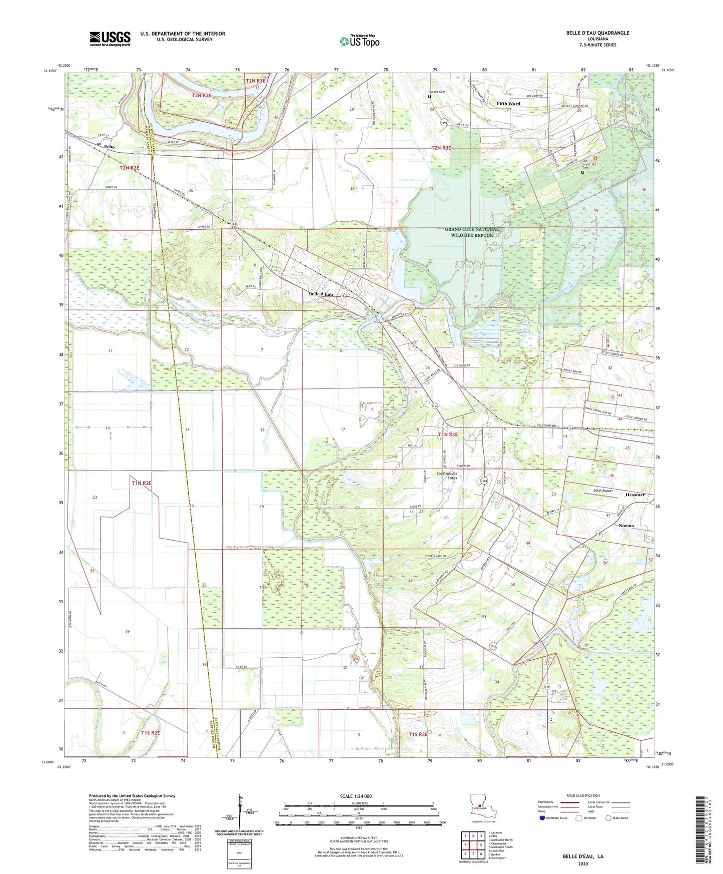
2024 topographic map quadrangle Belle d'Eau in the state of Louisiana. Scale: 1:24000. Based on the newly updated USGS 7.5' US Topo map series, this map is in the following counties: Avoyelles, Rapides. The map contains contour data, water features, and other items you are used to seeing on USGS maps, but also has updated roads and other features. This is the next generation of topographic maps. Printed on high-quality waterproof paper with UV fade-resistant inks.
Quads adjacent to this one:
West: Cheneyville
Northwest: Latanier
North: Effie
Northeast: Marksville North
East: Marksville South
Southeast: Cottonport
South: Bunkie
Southwest: Lone Pine
This map covers the same area as the classic USGS quad with code o31092a2.
Contains the following named places: Bayou Choctaw, Bayou des Allemands, Belle d'Eau, Belle D'Eau Airstrip, Bijou, Coulee du Pecheur, Detel Airport, Echo, Echo Census Designated Place, Echo Landing, Echo Post Office, Edgefield Church, Fifth Ward Census Designated Place, Grand Cote National Wildlife Refuge, Ile des Cotes, Les Grandes Cotes, Louisiana Noname 54 Dam, Louisiana School for the Agricultural Sciences, Norma, Oklahoma, Old Island Cemetery, Our Lady of Lourdes Catholic Church Cemetery, Parish Governing Authority District 12, Parish Governing Authority District 2, Saint Daniel Church, Saint Martin of Tours Church, Ward Five, Ward Four, ZIP Code: 71341