MyTopo
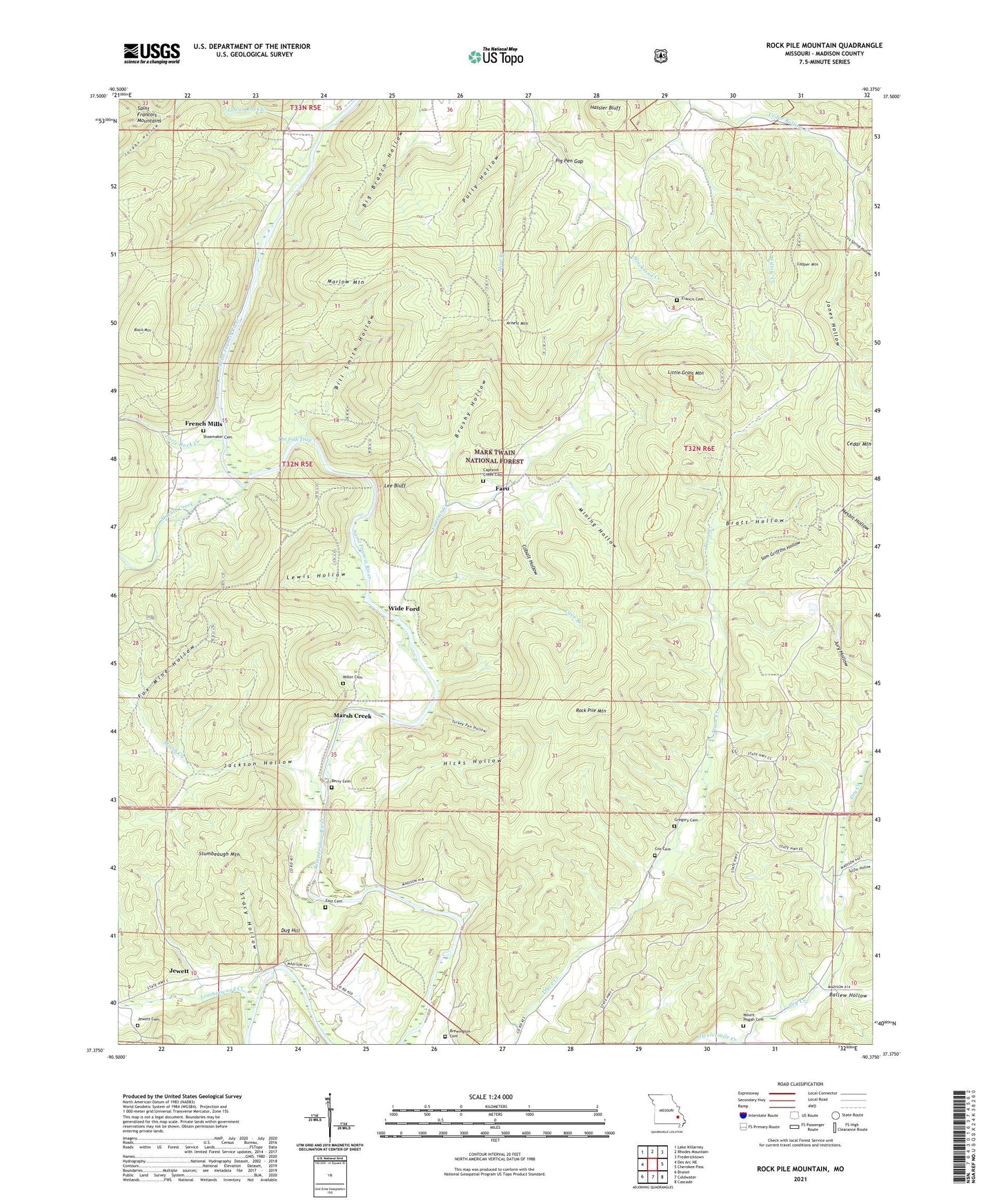
Rock Pile Mountain Missouri US Topo Map
Couldn't load pickup availability
Also explore the Rock Pile Mountain Forest Service Topo of this same quad for updated USFS data
2021 topographic map quadrangle Rock Pile Mountain in the state of Missouri. Scale: 1:24000. Based on the newly updated USGS 7.5' US Topo map series, this map is in the following counties: Madison. The map contains contour data, water features, and other items you are used to seeing on USGS maps, but also has updated roads and other features. This is the next generation of topographic maps. Printed on high-quality waterproof paper with UV fade-resistant inks.
Quads adjacent to this one:
West: Des Arc NE
Northwest: Lake Killarney
North: Rhodes Mountain
Northeast: Fredericktown
East: Cherokee Pass
Southeast: Cascade
South: Coldwater
Southwest: Brunot
This map covers the same area as the classic USGS quad with code o37090d4.
Contains the following named places: Arnett Mountain, Ballew Hollow, Berry Cemetery, Big Branch Hollow, Bill Smith Hollow, Black Mountain, Bratt Hollow, Brewington Cemetery, Brushy Hollow, Captain Creek, Captain Creek School, Captains Creek Cemetery, Cave Branch, Cedar Mountain, Cobalt Hollow, Copper Mountain, Cox Cemetery, Cox Spring Hollow, Dark Hollow, Dry Creek, Dug Hill, East Cemetery, Faro, Fox Mine Hollow, Francis Cemetery, French Mills, Greens Chapel, Greens Chapel School, Gregory Cemetery, Hassler Bluff, Henry Gaines Lake Dam, Hicks Hollow, Jackson Hollow, Jewett Cemetery, Jones Hollow, Jordan Hollow, King School, Leatherwood Creek, Lee Bluff, Lewis Hollow, Little Grass Mountain, Little Rock Creek, Lower Rock Creek, Marble Creek, Marlow Mountain, Marsh Creek, Miller Cemetery, Mine Branch, Mining Hollow, Mount Pisgah Cemetery, Mount Pisgah Church, Mount Pisgah School, Pig Pen Gap, Polly Hollow, Rock Pile Mountain, Rockpile Mountain Wilderness, Sam Griffths Hollow, Shoemaker Cemetery, Skaggs Lake Dam, Stacy Hollow, Stumbeaugh Mountain, Sulfur Hollow, The Fish Trap, Trace Creek School, Turkey Pen Hollow, Wide Ford, Willow Creek