
MyTopo
Siloam Springs Missouri US Topo Map
Couldn't load pickup availability
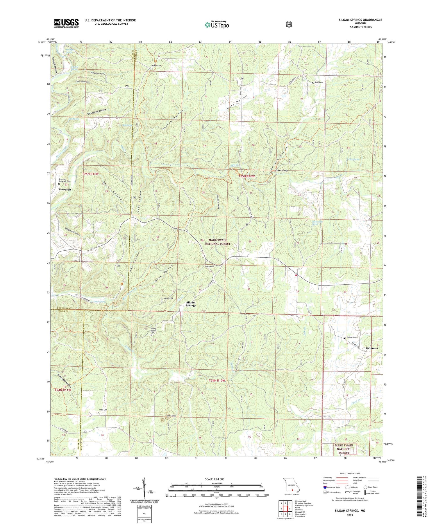
2021 topographic map quadrangle Siloam Springs in the state of Missouri. Scale: 1:24000. Based on the newly updated USGS 7.5' US Topo map series, this map is in the following counties: Howell, Douglas, Ozark. The map contains contour data, water features, and other items you are used to seeing on USGS maps, but also has updated roads and other features. This is the next generation of topographic maps. Printed on high-quality waterproof paper with UV fade-resistant inks.
Quads adjacent to this one:
West: Dora
Northwest: Nichols Knob
North: Dyestone Mountain
Northeast: Willow Springs South
East: Pomona
Southeast: South Fork
South: Pottersville
Southwest: Cureall NW
Contains the following named places: Anne Hollow, Blue Hole Hollow, Braddock Lake, Braddock Lake Dam, Buff Cemetery, Cathole Spring, Collins Cemetery, Dark Bottom Hollow, Grimmet, Hay Hollow, Hopkins School, Horton, Horton Cemetery, Horton Hollow, Horton Trailhead, Kenyon Hollow, Lick Branch, Lovers Leap, Martin Hill, May Hollow YCC Camp, Mine Hollow, Mine Hollow Branch, Mitts Cemetery, Moss Hollow, Oak Grove Church, Oak Grove School, Payne Knob, Pease Mill, Pumpkin Center Fire Department, Rattlesnake Spring, Ridge Runner NR Trail, Rocky Hollow, Roosevelt, Round Top School, Shingle Mill Hollow, Siloam Lookout Tower, Siloam Springs, Siloam Springs Cemetery, Siloam Springs Quad Number 1 Dam, Siloam Springs School, Smallpox Spring, Star School, Steer Stall Hollow, Still Spring, Sues Spring, Sues Spring Hollow, Tabor Spring, The Sinks, Thornton - Roosevelt Cemetery, Township of Siloam Springs, Turkey Spring, Turnbull Hollow, Turner School


