MyTopo
Brockway NE Montana US Topo Map
Couldn't load pickup availability
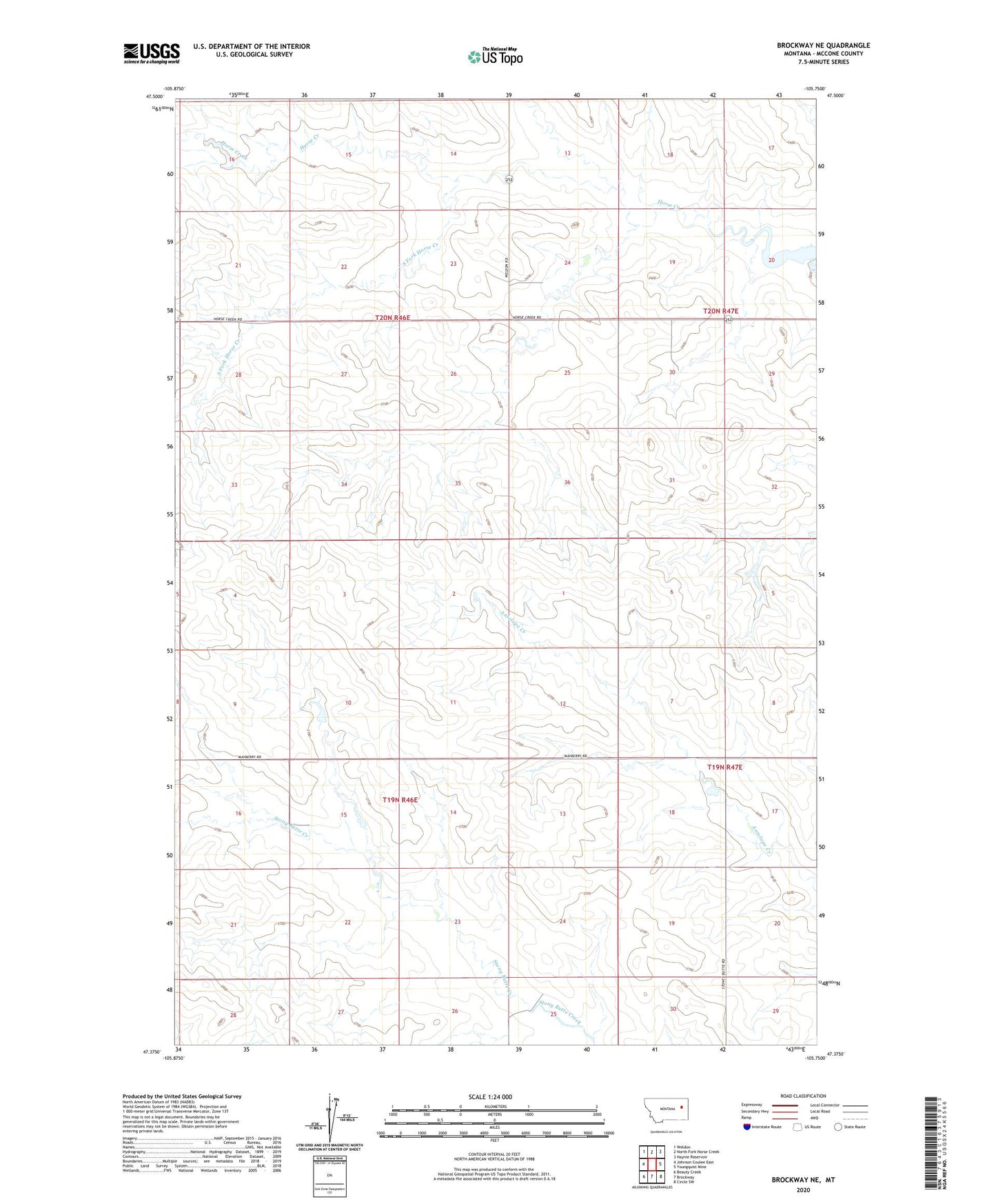
2024 topographic map quadrangle Brockway NE in the state of Montana. Scale: 1:24000. Based on the newly updated USGS 7.5' US Topo map series, this map is in the following counties: McCone. The map contains contour data, water features, and other items you are used to seeing on USGS maps, but also has updated roads and other features. This is the next generation of topographic maps. Printed on high-quality waterproof paper with UV fade-resistant inks.
Quads adjacent to this one:
West: Johnson Coulee East
Northwest: Weldon
North: North Fork Horse Creek
Northeast: Haynie Reservoir
East: Youngquist Mine
Southeast: Circle SW
South: Brockway
Southwest: Beauty Creek
This map covers the same area as the classic USGS quad with code o47105d7.
Contains the following named places: 19N46E10CDCA01 Well, 19N46E10CDCC01 Well, 19N46E15CBCA01 Well, 19N46E17DAAC01 Well, 19N46E17DAAD01 Well, 19N46E21ABBB01 Well, 19N46E23BBDB01 Well, 19N46E28ABBA01 Well, 19N47E08CCDC01 Well, 19N47E08DCDC01 Well, 19N47E17BCCB01 Well, 19N47E20CDAC01 Well, 20N46E13BBCC01 Well, 20N46E24CCDD01 Well, 20N46E24CDCC01 Well, 20N46E24DBCB01 Well, 20N46E27BCAB01 Well, 20N46E28ABBC01 Well, 20N46E28BAAD01 Well, 20N46E33BBAC01 Well, 20N46E34BCAA01 Well, 20N46E35DCAC01 Well, 20N46E36BBDA01 Well, 20N47E18ABAD01 Well, 20N47E29ABAA01 Well, 20N47E29ABAA02 Well, 20N47E29BBDB01 Well, 20N47E30ACCC01 Well, 20N47E30ACCC02 Well, 20N47E30ACCC03 Well, 20N47E30DBBA01 Well, 20N47E31DDBC01 Well, Circle Division, Horse Creek Post Office, L Pawlowske Number 1 Dam, Mathilda Number 1 Dam, Moos Number 1 Dam, North Fork Horse Creek, Pawlowski Reservoir Dam, South Fork Horse Creek, Wheatley Farms Number 1 Dam, Wheatley Farms Number 2 Dam