
MyTopo
Larchwood Montana US Topo Map
Couldn't load pickup availability
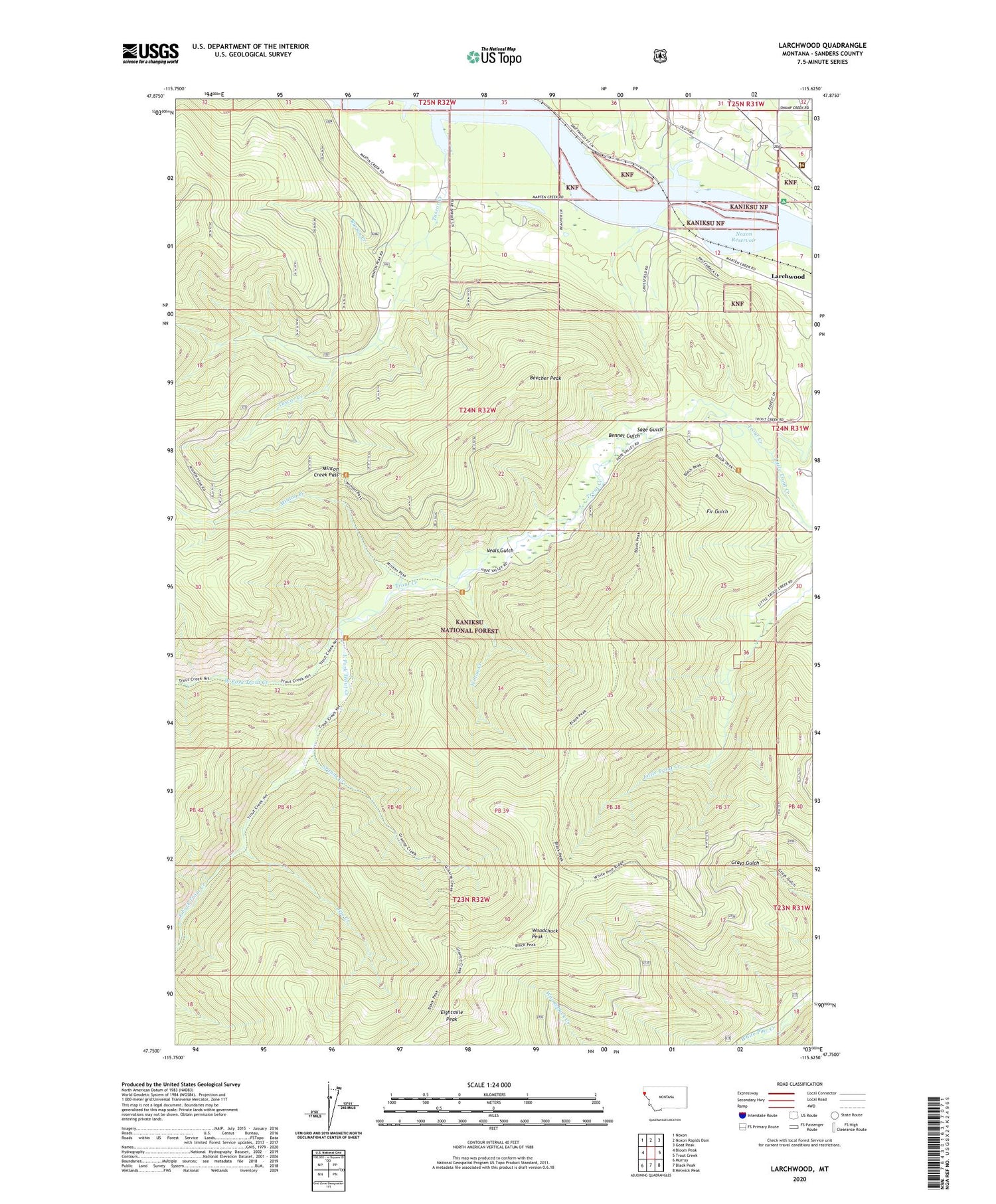
2020 topographic map quadrangle Larchwood in the state of Montana. Scale: 1:24000. Based on the newly updated USGS 7.5' US Topo map series, this map is in the following counties: Sanders. The map contains contour data, water features, and other items you are used to seeing on USGS maps, but also has updated roads and other features. This is the next generation of topographic maps. Printed on high-quality waterproof paper with UV fade-resistant inks.
Quads adjacent to this one:
West: Bloom Peak
Northwest: Noxon
North: Noxon Rapids Dam
Northeast: Goat Peak
East: Trout Creek
Southeast: Helwick Peak
South: Black Peak
Southwest: Murray
Contains the following named places: Ambassador Mine, Ambassador/Lulu Mine, Beecher Peak, Bennet Gulch, Bennet Gulch Mine, Black Peak Trail, Burton Creek, East Fork Trout Creek, Eightmile Peak, Granite Creek, Jew Creek, Larchwood, Little Trout Creek, Minton Creek, Minton Creek Pass, Noxon Reservoir, Sage Gulch, Trout Creek Campground, Trout Creek Ranger Station, Tuscor Creek, Veals Gulch, West Fork Trout Creek, White Penny Mine, Wilton Creek, Windfall Peak Trail, Woodchuck Peak


