MyTopo
Arapahoe North Carolina US Topo Map
Couldn't load pickup availability
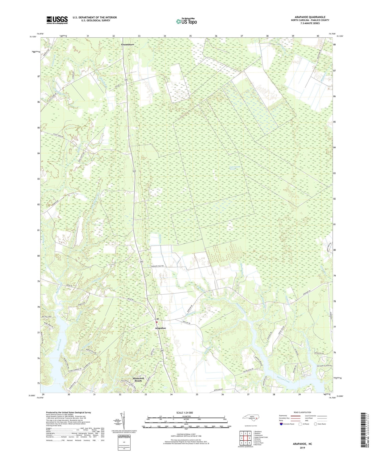
2022 topographic map quadrangle Arapahoe in the state of North Carolina. Scale: 1:24000. Based on the newly updated USGS 7.5' US Topo map series, this map is in the following counties: Pamlico. The map contains contour data, water features, and other items you are used to seeing on USGS maps, but also has updated roads and other features. This is the next generation of topographic maps. Printed on high-quality waterproof paper with UV fade-resistant inks.
Quads adjacent to this one:
West: Upper Broad Creek
Northwest: Reelsboro
North: Bayboro
Northeast: Vandemere
East: Oriental
Southeast: Merrimon
South: Cherry Point
Southwest: Havelock
This map covers the same area as the classic USGS quad with code o35076a7.
Contains the following named places: Arapahoe, Arapahoe Elementary School, Arapahoe Fire and Rescue Department, Arapahoe Free Will Baptist Church, Arapahoe Post Office, Beard Creek, Beards Creek, Bethany Christian Church, Caraway Creek, Cash Corner Number 2, Cedar Gut, Deep Run, Deep Run Branch, East Prong Beard Creek, Fork Run, Granny Gut, Holts Chapel, Light Ground Pocosin, Purifoy Gut, Saint Matthews Church, Saint Stephens Church, Simmons Branch, Tarkiln Creek, Town of Arapahoe, Township 5, Wheeler Gut, ZIP Code: 28529