MyTopo
Bayboro North Carolina US Topo Map
Couldn't load pickup availability
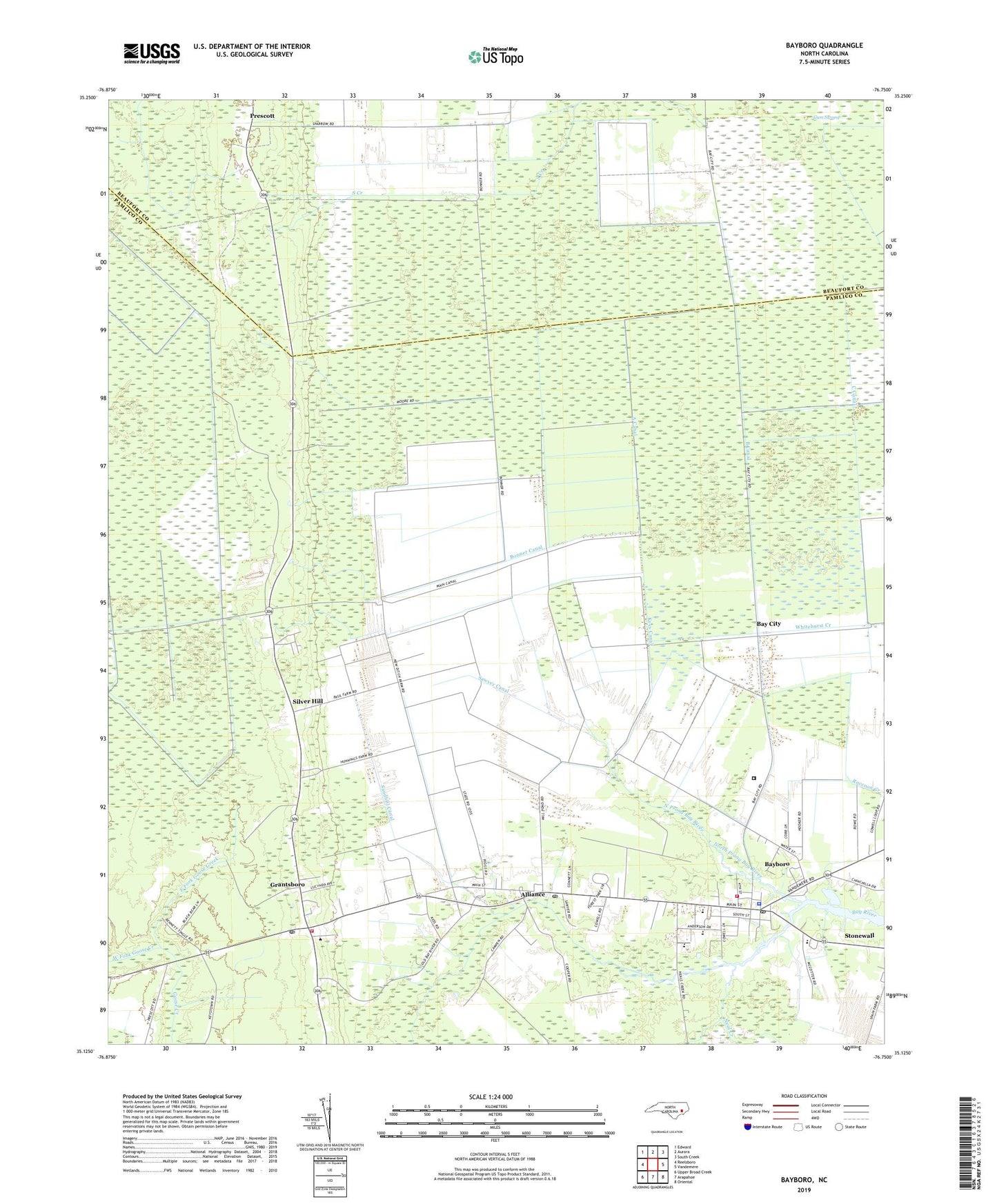
2022 topographic map quadrangle Bayboro in the state of North Carolina. Scale: 1:24000. Based on the newly updated USGS 7.5' US Topo map series, this map is in the following counties: Pamlico, Beaufort. The map contains contour data, water features, and other items you are used to seeing on USGS maps, but also has updated roads and other features. This is the next generation of topographic maps. Printed on high-quality waterproof paper with UV fade-resistant inks.
Quads adjacent to this one:
West: Reelsboro
Northwest: Edward
North: Aurora
Northeast: South Creek
East: Vandemere
Southeast: Oriental
South: Arapahoe
Southwest: Upper Broad Creek
This map covers the same area as the classic USGS quad with code o35076b7.
Contains the following named places: A Canal, Alliance, Alliance Post Office, B Canal, Bay City, Bayboro, Bayboro Post Office, Bonner Canal, Britthaven of Pamlico, C Canal, Central School, East Fork Goose Greek, Flowers Canal, Fred A Anderson Elementary School, Grantsboro, Grantsboro Post Office, Grantsboro Silverhill Volunteer Fire Department, Green Hill Church, Keys Canal, Neal Creek, North Prong Bay River, Pamlico Airport, Pamlico Correctional Institution, Pamlico County Sheriff's Office, Pamlico High School, Pamlico Rescue Squad, Prescott, Rock of Zion Church, Saint Marks Church, Sandhill, Sandhill Canal, Sawyer Canal, Silver Hill, South Prong Bay River, Town of Alliance, Town of Bayboro, Town of Grantsboro, Township 3, Triangle Volunteer Fire Department, West Alliance Station, West Branch Church, West Fork Goose Creek, Whitehurst Creek