MyTopo
Aurora North Carolina US Topo Map
Couldn't load pickup availability
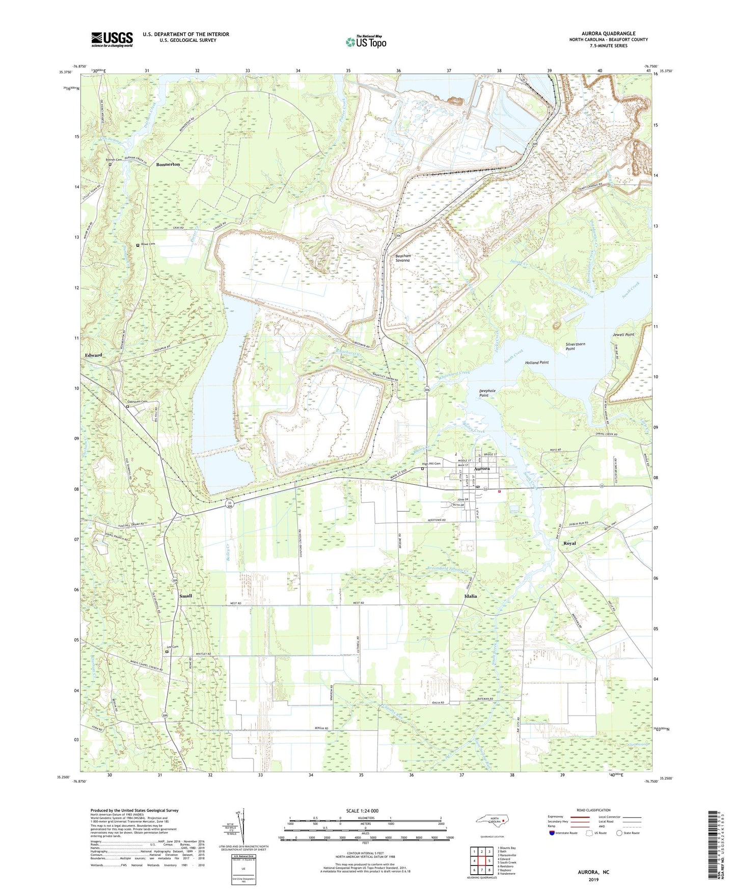
2022 topographic map quadrangle Aurora in the state of North Carolina. Scale: 1:24000. Based on the newly updated USGS 7.5' US Topo map series, this map is in the following counties: Beaufort. The map contains contour data, water features, and other items you are used to seeing on USGS maps, but also has updated roads and other features. This is the next generation of topographic maps. Printed on high-quality waterproof paper with UV fade-resistant inks.
Quads adjacent to this one:
West: Edward
Northwest: Blounts Bay
North: Bath
Northeast: Ransomville
East: South Creek
Southeast: Vandemere
South: Bayboro
Southwest: Reelsboro
This map covers the same area as the classic USGS quad with code o35076c7.
Contains the following named places: Aurora, Aurora Fossil Museum, Aurora High School, Aurora Police Department, Aurora Post Office, Aurora Volunteer Fire Department, Aurora Wastewater Treatment Plant, Bailey Creek, Beach Grove, Beacham Savanna, Bethel Church, Bonner Cemetery, Bonnerton, Broomfield Swamp Creek, Cedar Grove Church, Cypress Run, Deephole Point, Drinkwater Creek, Dublin Grove Church, Friendship Church, Guilford Station, Gum Swamp Run, High Hill Cemetery, Holland Point, Holy Temple, Hookers Chapel, Idalia, Jacks Creek, Jacobs Creek, Jewell Point, Lee Cemetery, Little Creek, Marys Chapel, Moses Church, Mount Olive Church, Mount Shiloh Church, Oak Grove Church, Oakhaven Cemetery, Philip Chapel, Rowe Cemetery, Royal, S W Snowden Elementary School, Saint John Missionary Baptist Church, Saint Johns Church, Saint Matthews Church, Saint Peter Church, Saint Stephen Church, Sandy Grove Church, Silverthorn Point, Small, Tan Swamp, Town of Aurora, Township of Richland, Weeping Rachel Church, Whitehill Church, Whitehurst Creek, ZIP Codes: 27806, 27821