MyTopo
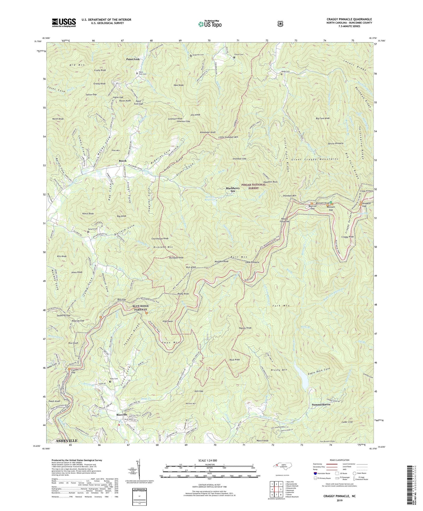
Craggy Pinnacle North Carolina US Topo Map
Couldn't load pickup availability
Also explore the Craggy Pinnacle Forest Service Topo of this same quad for updated USFS data
2022 topographic map quadrangle Craggy Pinnacle in the state of North Carolina. Scale: 1:24000. Based on the newly updated USGS 7.5' US Topo map series, this map is in the following counties: Buncombe. The map contains contour data, water features, and other items you are used to seeing on USGS maps, but also has updated roads and other features. This is the next generation of topographic maps. Printed on high-quality waterproof paper with UV fade-resistant inks.
Quads adjacent to this one:
West: Weaverville
Northwest: Mars Hill
North: Barnardsville
Northeast: Mount Mitchell
East: Montreat
Southeast: Black Mountain
South: Oteen
Southwest: Asheville
This map covers the same area as the classic USGS quad with code o35082f4.
Contains the following named places: Alexander Branch, Alexander Knob, Anderson Cove Cemetery, Ballard Cemetery, Ballard Cove, Barrett Cove, Bartlett Mountain, Bearpen Gap, Bearpen Knob, Bearwallow Branch, Bee Branch, Bee Tree Lake Dam, Beech, Beetree Church, Beetree Gap, Beetree Reservoir, Bell Branch, Big Fork Knob, Big Fork Ridge, Blackberry Inn, Browns Chapel, Brushy Mountain, Bull Gap, Bull Mountain, Camel Field, Camp Sequoyah, Carter Creek, Cedar Cliff, Copperas Mountain, Courthouse Knob, Craggy Flats, Craggy Gardens, Craggy Knob, Craggy Mountain Scenic Area, Craggy Pinnacle, Craven Gap, Douglas Falk, Eagle Rock Cove, Eller Cove, Fork Mountain, Frosty Knob, Grassy Knob, Great Craggy Mountains, Gregg Branch, Haw Knob, Hawkbill Creek, Hawkbill Rock, High Swan, Honeycut Cove, Huey Cemetery, Ingles Gap, Jack Gap, Jay Allen Cemetery, Jess Knob, Jimmy Branch, Jones Cove, Jones Knob, Jump Cove, Keasler Branch, Kits Knob, Lane Pinnacle, Laurel Fork, Left Fork Beetree Creek, Little Fork Ridge, Little Snowball Mountain, Long Branch, Lovelace Gap, Lovelace Knob, Maney Branch, McDaires Cove, McDaires Ridge, Middle Mountain, Mineral Creek, Moody Cove, North Knob, Ox Creek Church, Paint Fork, Paint Fork Cemetery, Paint Fork Gap, Paynes Knob, Peach Knob, Peach Orchard Creek, Pennix Cove, Pine Mountain, Pinnacle Gap, Potato Field Gap, Rattlesnake Lodge, Raven Knob, Ray Cove, Ray Knob, Rice Knob, Riceville, Riceville Church, Riceville Volunteer Fire Department, Rich Knob, Richland Knob, Richland Mountain, Right Fork Beetree Creek, Roaring Gap, Rock Knob, Rocky Knob, Salton Gap, Sassafras Gap, Sawmill Branch, Sawyer Cove, Shope Creek, Snowball Gap, Snowball Mountain, Spruce Fork, Spruce Pinnacle, Sprucepine Ridge, Sugar Cove, Sugarcamp Fork, Summerhaven, Swan Mountain, Tanbark Ridge, Union Valley Church, Vance Knob, Watch Knob, Waterfall Creek, Webb Cemetery, Wolf Branch, Wolfden Knob, Wolfe Branch, Woodfin Reservoir, Woodfin Reservoir Dam, ZIP Codes: 28778, 28805