
MyTopo
Upper Broad Creek North Carolina US Topo Map
Couldn't load pickup availability
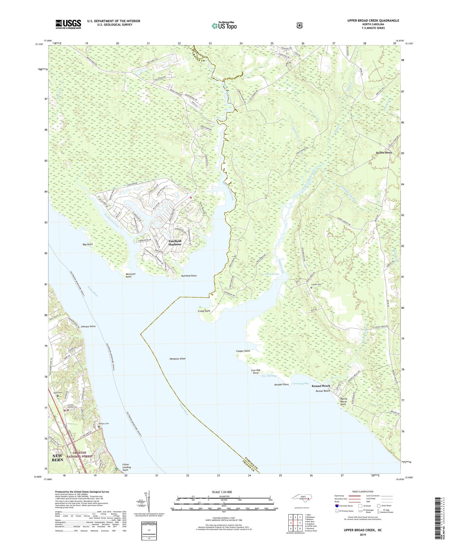
2019 topographic map quadrangle Upper Broad Creek in the state of North Carolina. Scale: 1:24000. Based on the newly updated USGS 7.5' US Topo map series, this map is in the following counties: Pamlico, Craven. The map contains contour data, water features, and other items you are used to seeing on USGS maps, but also has updated roads and other features. This is the next generation of topographic maps. Printed on high-quality waterproof paper with UV fade-resistant inks.
Quads adjacent to this one:
West: New Bern
Northwest: Askin
North: Reelsboro
Northeast: Bayboro
East: Arapahoe
Southeast: Cherry Point
South: Havelock
Southwest: Catfish Lake
Contains the following named places: Alexander Swamp, Amity Church, Barbara Bolling Flynn Assisted Living Facility, Bay Point, Black Creek, Boyd Cemetery, Carraway Bay, Cayton Cemetery, Conner Family Cemetery, Cooper Point, Creek Point, Cypress Creek, Deep Run, Fairfield Harbour, Fairfield Harbour Census Designated Place, Fisher Landing Point, Fisher Landing Recreation Site, Gaston Swamp, Goose Creek, Hampton Shoal, Johnson Point, Kendall Point, Kennel Beach, Lees Landing, Live Oak Bay, Live Oak Point, Lower Duck Creek, McCotter Point, Myrtle Marsh Point, New Bethlehem Church, Northwest Creek, Northwest Creek Marina, Number 7 Township Fire and Rescue Department - Station 3, Pelham Cemetery, Rowland Point, Saint Bartholomew's Anglican Catholic Church, Scotts Store, Tri - Community Fire Department, Union Chapel, Upper Broad Creek, Wood Landing


