MyTopo
Vandemere North Carolina US Topo Map
Couldn't load pickup availability
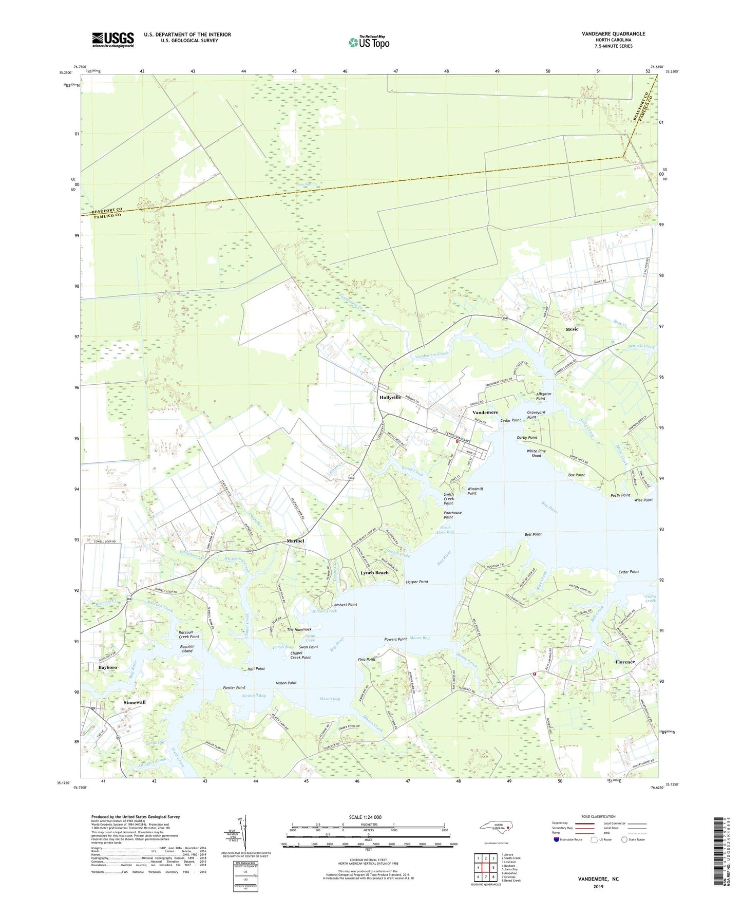
2019 topographic map quadrangle Vandemere in the state of North Carolina. Scale: 1:24000. Based on the newly updated USGS 7.5' US Topo map series, this map is in the following counties: Pamlico, Beaufort. The map contains contour data, water features, and other items you are used to seeing on USGS maps, but also has updated roads and other features. This is the next generation of topographic maps. Printed on high-quality waterproof paper with UV fade-resistant inks.
Quads adjacent to this one:
West: Bayboro
Northwest: Aurora
North: South Creek
Northeast: Lowland
East: Jones Bay
Southeast: Broad Creek
South: Oriental
Southwest: Arapahoe
Contains the following named places: Alligator Creek, Alligator Point, Antioch Church, Armstrong Creek, Ball Creek, Bay Creek Church, Bee Tree Creek, Bell Point, Box Point, Cabin Creek, Cedar Creek, Cedar Point, Chapel Creek, Chapel Creek Point, Chappel Creek, Concord Church, Darby Point, Flea Point, Florence, Florence - Whortonsville Volunteer Fire Department, Fowler Point, Graveyard Point, Gum Swamp, Hall Point, Harper Creek, Harper Point, Harris Creek, Hollyville, Lambert Point, Lewis Creek, Little Pasture Creek, Little Vandemere Creek, Log Pond Creek, Long Creek, Lynch Beach, Maribel, Maribel School, Mason Bay, Mason Creek, Mason Point, Mesic, Mesic Creek, Moore Bay, Moore Creek, Mount Olive Church, Mount Sinai Church, Mount Zion Church, Newton Creek, Pamlico County, Parch Corn Bay, Pasture Creek, Petty Point, Poorhouse Point, Powers Point, Punch Bowl, Raccoon Creek, Raccoon Creek Point, Raccoon Island, Rice Creek, Saint Galilee Church, Saint James Church, Saint Mark Church, Saint Peters Church, Simpson Creek, Smith Creek, Smith Creek Point, Stonewall, Stonewall Post Office, Swan Corner, Swan Cove, Swan Point, Swindell Bay, Tempe Gut, The Hammock, Town of Mesic, Town of Stonewall, Town of Vandemere, Trent Creek, Turtle Gut, Vandemere, Vandemere Creek, Vandemere Fire Department, White Pine Shoal, Whitehurst Creek, Windmill Point, Wise Point, ZIP Codes: 28515, 28583, 28587