MyTopo
Ashwood Texas US Topo Map
Couldn't load pickup availability
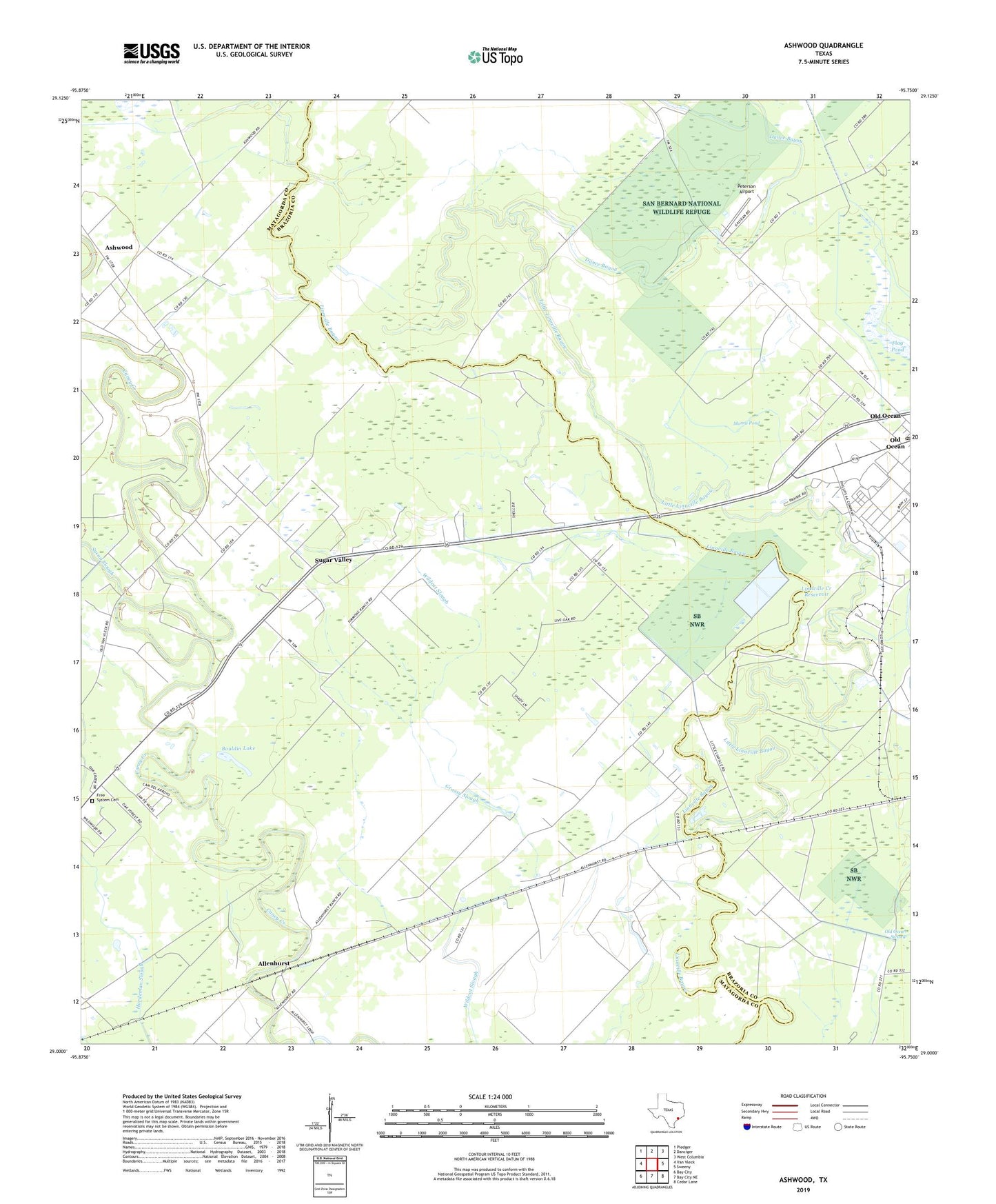
2022 topographic map quadrangle Ashwood in the state of Texas. Scale: 1:24000. Based on the newly updated USGS 7.5' US Topo map series, this map is in the following counties: Matagorda, Brazoria. The map contains contour data, water features, and other items you are used to seeing on USGS maps, but also has updated roads and other features. This is the next generation of topographic maps. Printed on high-quality waterproof paper with UV fade-resistant inks.
Quads adjacent to this one:
West: Van Vleck
Northwest: Pledger
North: Danciger
Northeast: West Columbia
East: Sweeny
Southeast: Cedar Lane
South: Bay City NE
Southwest: Bay City
This map covers the same area as the classic USGS quad with code o29095a7.
Contains the following named places: Abercrombie, Allenhurst, Ashwood, Bethlehem Church, Bouldin Lake, Dance Bayou, Free System Cemetery, Grassy Slough, Hasima, Linnville Creek Reservoir, Linnville Creek Reservoir Dam, Little Linnville Bayou, Morris Pond, Old Ocean Post Office, Peterson Airport, Snead Slough, Sugar Valley, Sugar Valley Oil Field, Union Church, ZIP Code: 77480