MyTopo
Bay City NE Texas US Topo Map
Couldn't load pickup availability
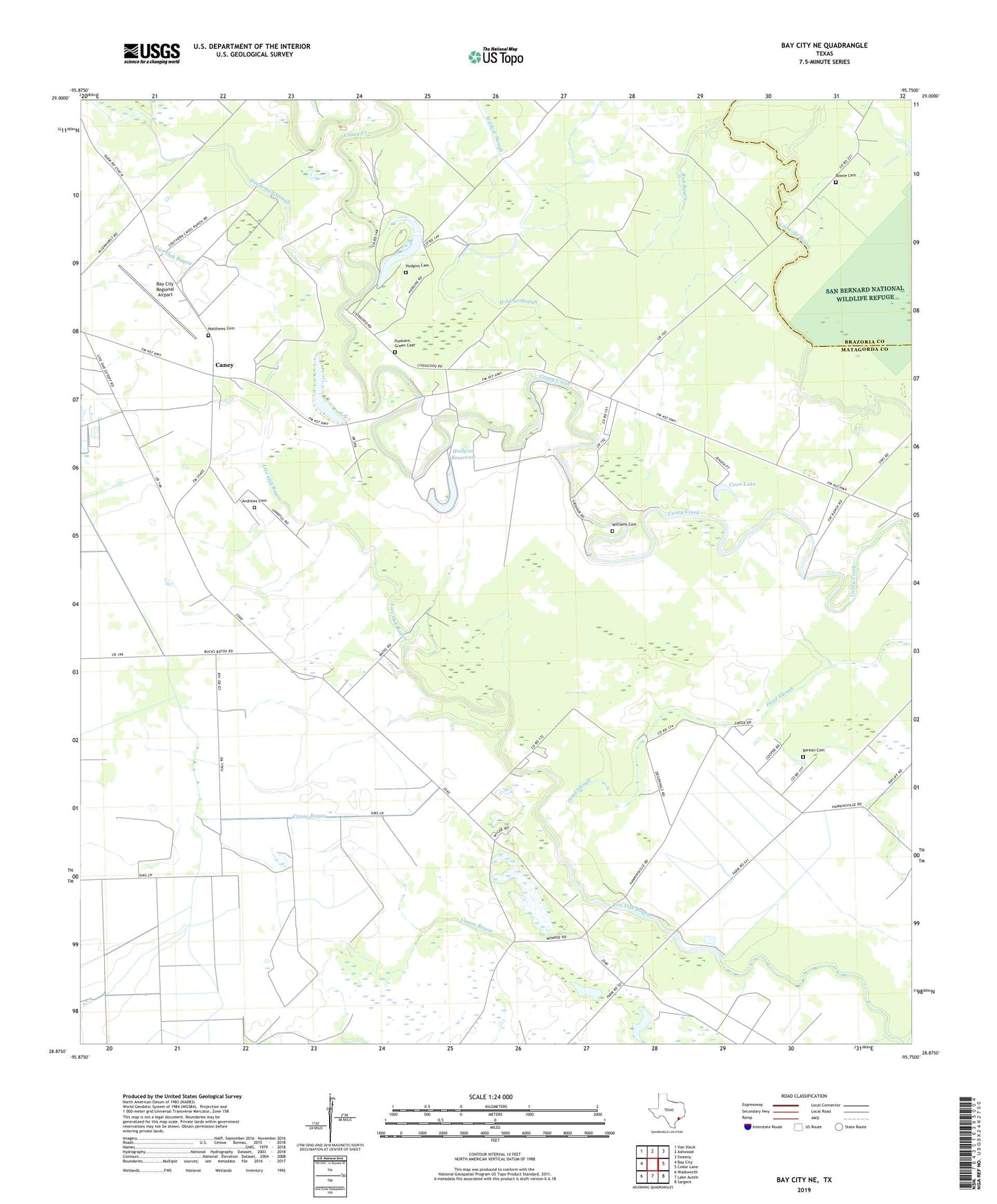
2022 topographic map quadrangle Bay City NE in the state of Texas. Scale: 1:24000. Based on the newly updated USGS 7.5' US Topo map series, this map is in the following counties: Matagorda, Brazoria. The map contains contour data, water features, and other items you are used to seeing on USGS maps, but also has updated roads and other features. This is the next generation of topographic maps. Printed on high-quality waterproof paper with UV fade-resistant inks.
Quads adjacent to this one:
West: Bay City
Northwest: Van Vleck
North: Ashwood
Northeast: Sweeny
East: Cedar Lane
Southeast: Sargent
South: Lake Austin
Southwest: Wadsworth
This map covers the same area as the classic USGS quad with code o28095h7.
Contains the following named places: Andrews Cemetery, Bay City Regional Airport, Berean Cemetery, Berean Church, Boone Cemetery, Caney, Coon Lake, Fay Ranch Airport, Fay Ranch Dam, Fay Ranch Reservoir, Hardeman Slough, Hudgins Cemetery, Hudgins Dam, Hudgins Reservoir, Linnville Church, Matthews Cemetery, Mount Pilgrim Church, Pleasant Green Cemetery, Red Bayou, Rugeley, Vine Grove Church, Vine Grove School, Wildcat Slough, Williams Cemetery, ZIP Code: 77414