MyTopo
A Bar A Ranch Texas US Topo Map
Couldn't load pickup availability
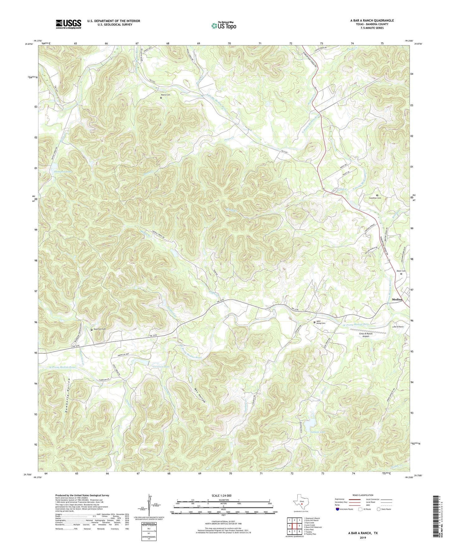
2022 topographic map quadrangle A Bar A Ranch in the state of Texas. Scale: 1:24000. Based on the newly updated USGS 7.5' US Topo map series, this map is in the following counties: Bandera. The map contains contour data, water features, and other items you are used to seeing on USGS maps, but also has updated roads and other features. This is the next generation of topographic maps. Printed on high-quality waterproof paper with UV fade-resistant inks.
Quads adjacent to this one:
West: Love Creek
Northwest: Diamond S Ranch
North: Echo Hill Ranch
Northeast: Fall Creek
East: Rock Cliff Reservoir
Southeast: Tarpley Pass
South: Tarpley
Southwest: Seco Pass
This map covers the same area as the classic USGS quad with code o29099g3.
Contains the following named places: A Bar A Ranch, Anchor T Ranch, Baker Cemetery, Bauerlein Cemetery, Bauerlein Creek, Benton Creek, Carpenter Creek, Cazey Creek, Chalk Creek, Cinco B Ranch Airport, Circle R Resort Ranch Airport, Circle R Sky Ranch, Coalkiln Creek, Cripple Creek Ranch, Dewberry Hollow, Elm Creek, Gallant Lake, Gallant Lake Dam, Garrison Lake, Garrison Lake Dam, Goodman Cemetery, Horse Creek, Horse Valley Ranch, Hough Creek, Idlewild Airport, Means Cemetery, Mickle Creek, North Prong Medina River, Pecan Creek, Pecan Ranch, Rhyme Creek, Rocky Creek, Rocky River Ranch, Spring Creek, Stanford Creek, Thompson Lake, Thompson Lake Dam, Wallace Creek, West Prong Cemetery, West Prong Medina River, Wet Hollow, ZIP Code: 78055