MyTopo
Rudolph Texas US Topo Map
Couldn't load pickup availability
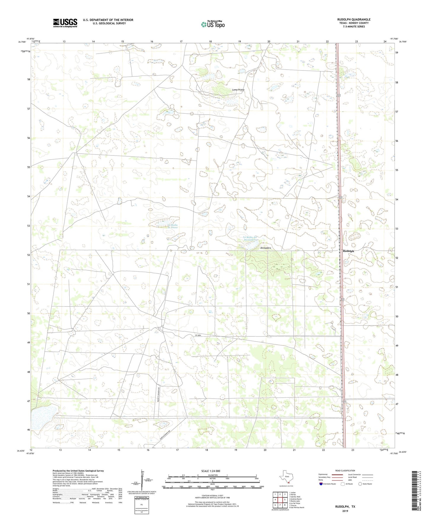
2022 topographic map quadrangle Rudolph in the state of Texas. Scale: 1:24000. Based on the newly updated USGS 7.5' US Topo map series, this map is in the following counties: Kenedy. The map contains contour data, water features, and other items you are used to seeing on USGS maps, but also has updated roads and other features. This is the next generation of topographic maps. Printed on high-quality waterproof paper with UV fade-resistant inks.
Quads adjacent to this one:
West: Andrea Ranch
Northwest: Julian
North: Norias
Northeast: Saltillo Well
East: Rosita Lake
Southeast: San Perlita North
South: Yturria
Southwest: La Sal Vieja
This map covers the same area as the classic USGS quad with code o26097f7.
Contains the following named places: Auras Artesian Well, Chaleco Artesian Well, Conchita Artesian Well, Divisadero, Garcia Ranch, KSOX-FM (Raymondville), La Badia de Pitoso, La Badia del Divisadero, Loma Prieta, Los Cuates Windmill, Maravillas Well, Mota Verde Artesian Well, Noria Nueva Artesian Well, Pitoso Artesian Well, Rudolph