MyTopo
Devine Texas US Topo Map
Couldn't load pickup availability
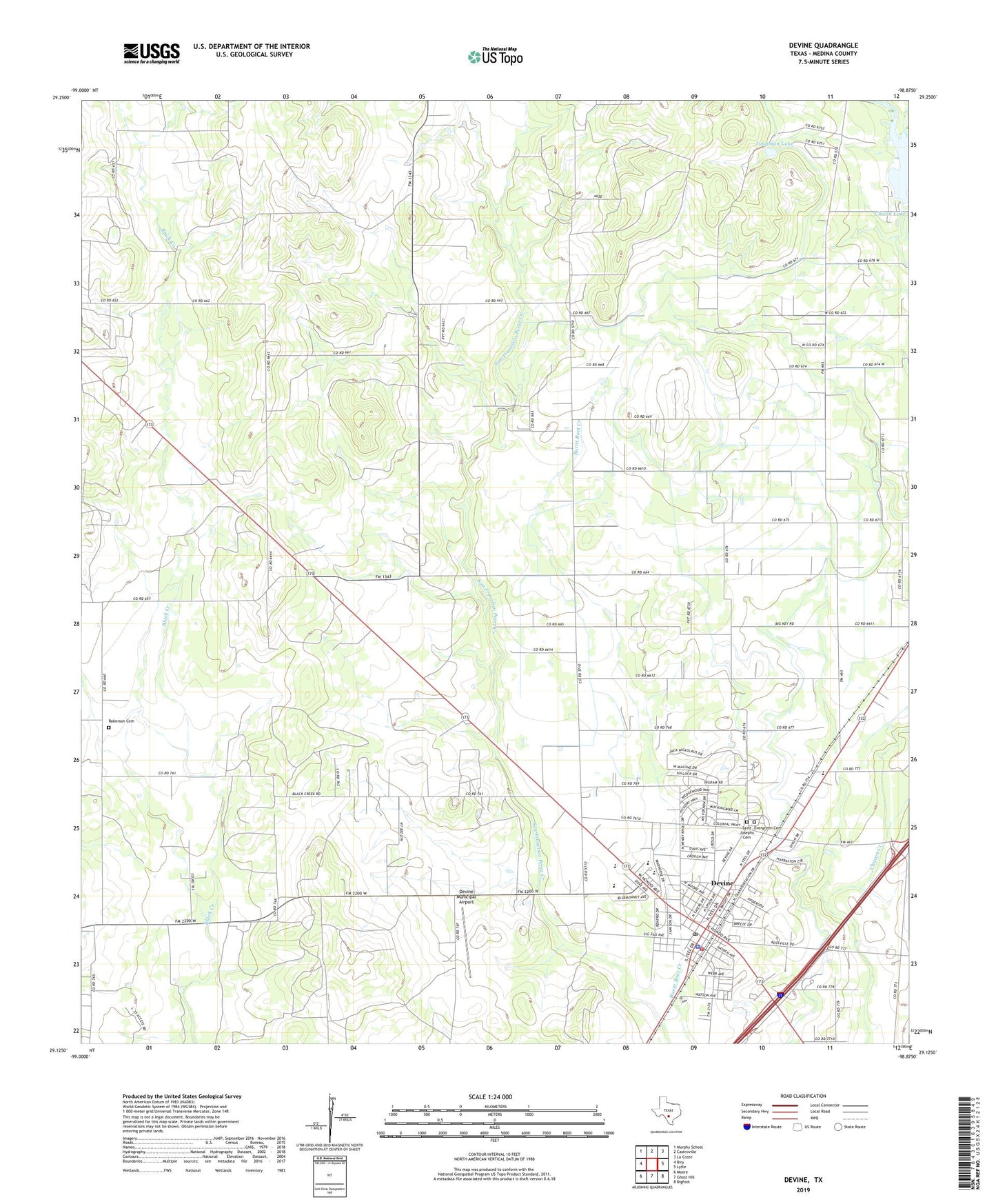
2022 topographic map quadrangle Devine in the state of Texas. Scale: 1:24000. Based on the newly updated USGS 7.5' US Topo map series, this map is in the following counties: Medina. The map contains contour data, water features, and other items you are used to seeing on USGS maps, but also has updated roads and other features. This is the next generation of topographic maps. Printed on high-quality waterproof paper with UV fade-resistant inks.
Quads adjacent to this one:
West: Biry
Northwest: Murphy School
North: Castroville
Northeast: La Coste
East: Lytle
Southeast: Bigfoot
South: Ghost Hill
Southwest: Moore
This map covers the same area as the classic USGS quad with code o29098b8.
Contains the following named places: Betania Baptist Mission Church, Bethel Assembly of God Church, Black Creek Church, Chacon Reservoir, Chicon Lake, Chicon Lake Dam, City of Devine, Colonial Oaks Park, Devine, Devine City Hall, Devine City Park, Devine Emergency Medical Service, Devine High School, Devine Intermediate School, Devine Middle School, Devine Municipal Airport, Devine Opera House, Devine Police Department, Devine Post Office, Devine Volunteer Fire Department, Devine-Natalia Division, Evergreen Cemetery, John J Ciavarra Elementary School, Jungman Lake, KTXX-FM (Devine), Medina County Constable's Office Precinct 4, Medina Lake State Fish Hatchery, Primitive Church, Roberson Cemetery, Rose Hill Church of Christ, Saint Josephs Cemetery, ZIP Code: 78016