MyTopo
Yturria Texas US Topo Map
Couldn't load pickup availability
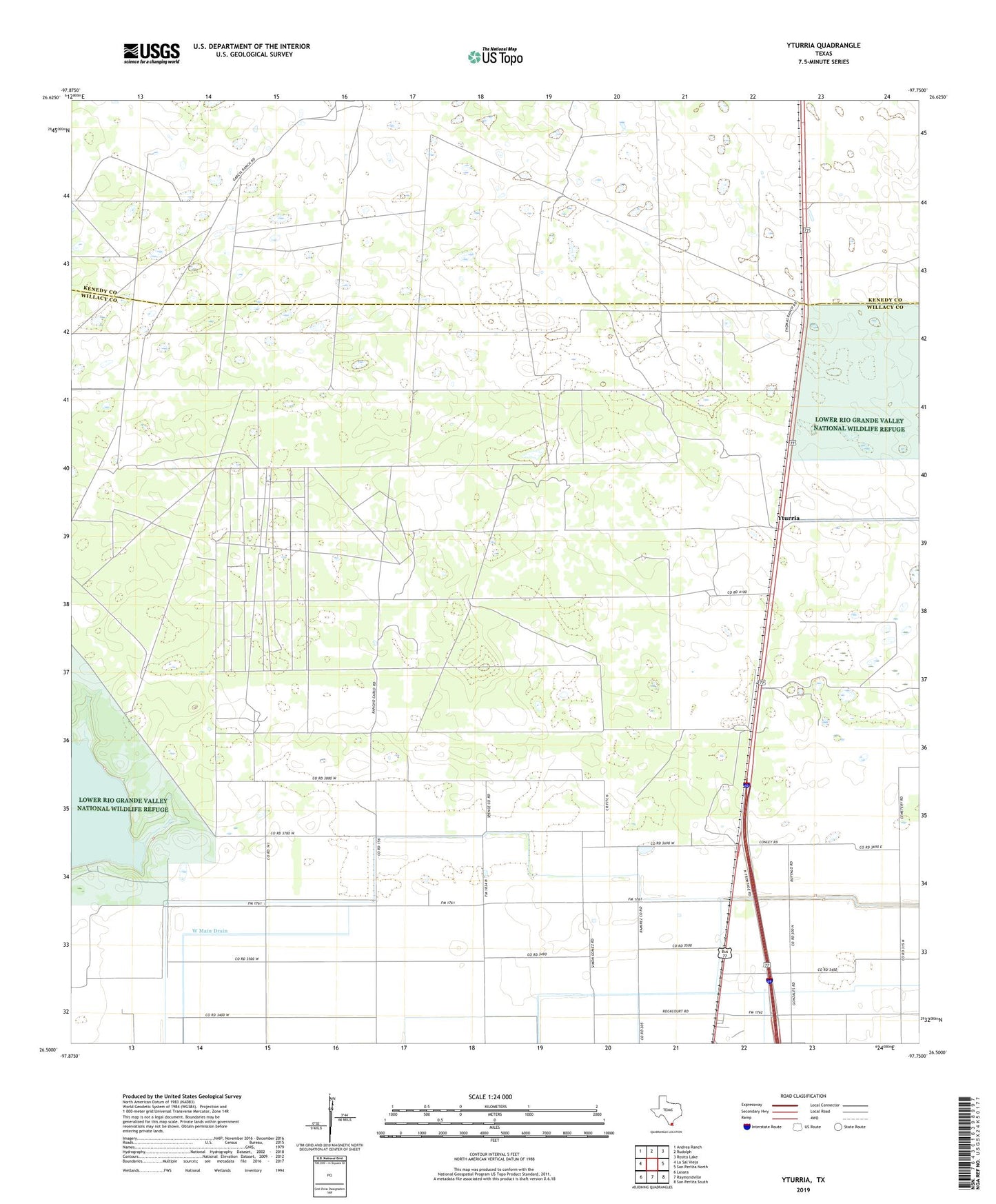
2022 topographic map quadrangle Yturria in the state of Texas. Scale: 1:24000. Based on the newly updated USGS 7.5' US Topo map series, this map is in the following counties: Willacy, Kenedy. The map contains contour data, water features, and other items you are used to seeing on USGS maps, but also has updated roads and other features. This is the next generation of topographic maps. Printed on high-quality waterproof paper with UV fade-resistant inks.
Quads adjacent to this one:
West: La Sal Vieja
Northwest: Andrea Ranch
North: Rudolph
Northeast: Rosita Lake
East: San Perlita North
Southeast: San Perlita South
South: Raymondville
Southwest: Lasara
This map covers the same area as the classic USGS quad with code o26097e7.
Contains the following named places: Ano Nuevo Windmill, Artesiano Windmill, Benitez Colonia, Coast Guard Station Raymondville, El Chapote Colonia, El Ebanito Windmill, Esperanza Ranch, La Chata Ranch, La Sal Windmill, Laguna Panda Windmill, Lisa Colonia, Los Ansares Windmill, Los Cedros Artesian Wells, Saltine Windmill, Steer Windmill, Thomas Ranch, Toro Melon Windmill, West Main Drain, Willacy Acres Colonia, Yturria