MyTopo
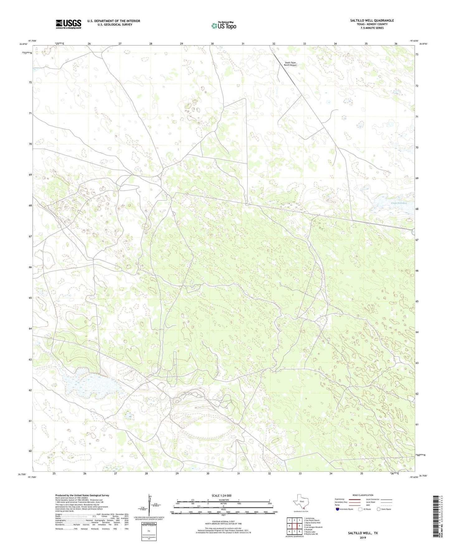
Saltillo Well Texas US Topo Map
Couldn't load pickup availability
2022 topographic map quadrangle Saltillo Well in the state of Texas. Scale: 1:24000. Based on the newly updated USGS 7.5' US Topo map series, this map is in the following counties: Kenedy. The map contains contour data, water features, and other items you are used to seeing on USGS maps, but also has updated roads and other features. This is the next generation of topographic maps. Printed on high-quality waterproof paper with UV fade-resistant inks.
Quads adjacent to this one:
West: Norias
Northwest: Armstrong
North: San Pedro Ranch
Northeast: Maria Estella Well
East: Los Amigos Windmill
Southeast: Rosita Lake NE
South: Rosita Lake
Southwest: Rudolph
This map covers the same area as the classic USGS quad with code o26097g6.
Contains the following named places: Borrego Windmill, Chicago Windmill, Escondido Artesian Well, La Fortuna Artesian Well, Medanito Artesian Well, Mike Windmill, Moto Mesquite Artesian Well, Norias Headquarters King Ranch, Norias School, Papalote Mocho Artesian Well, Roberta Artesian Well, Saltillo Artesian Well, Salvador Artesian Well, Salvador Windmill, San Francisco Artesian Well, San Ignacio Artesian Well, Soledad Artesian Well, South Tajos Ranch Airport, Tejones Artesian Well