MyTopo
Poe Mountain Washington US Topo Map
Couldn't load pickup availability
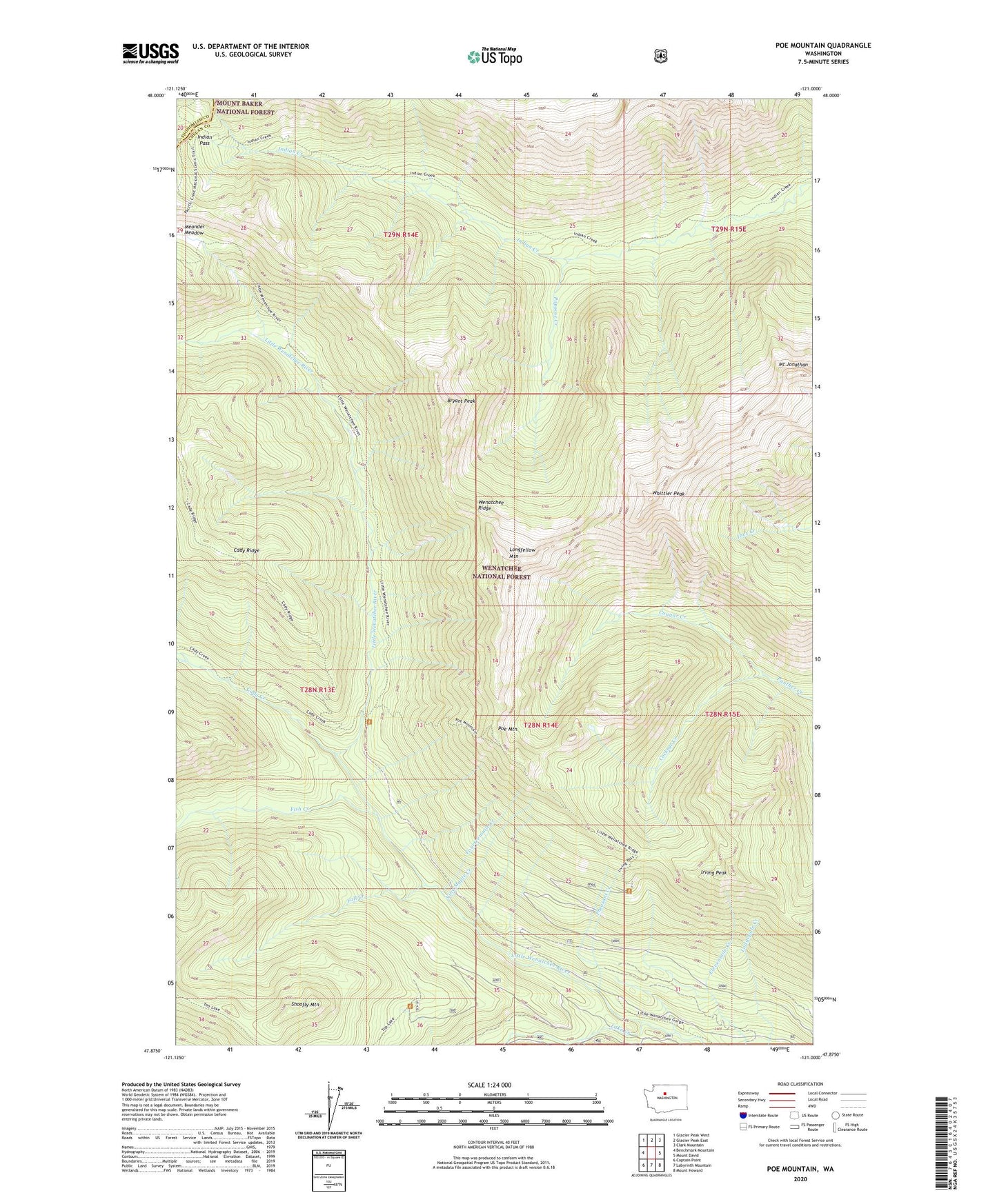
2020 topographic map quadrangle Poe Mountain in the state of Washington. Scale: 1:24000. Based on the newly updated USGS 7.5' US Topo map series, this map is in the following counties: Chelan, Snohomish. The map contains contour data, water features, and other items you are used to seeing on USGS maps, but also has updated roads and other features. This is the next generation of topographic maps. Printed on high-quality waterproof paper with UV fade-resistant inks.
Quads adjacent to this one:
West: Benchmark Mountain
Northwest: Glacier Peak West
North: Glacier Peak East
Northeast: Clark Mountain
East: Mount David
Southeast: Mount Howard
South: Labyrinth Mountain
Southwest: Captain Point
Contains the following named places: Bryant Peak, Cady Creek, Cockeye Creek, Cougar Creek, Fall Creek, Fish Creek, Fourteenmile Creek, Indian Pass, Irving Peak, Lake Creek, Lake Creek Campground, Little Wenatchee Ford Campground, Longfellow Mountain, Meander Meadow, Mount Jonathan, Papoose Creek, Pheasant Creek, Poe Mountain, Shoofly Mountain, Thirteenmile Creek, Twelvemile Creek, Vine Maple Creek, Wenatchee Ridge, Whittier Peak