MyTopo
Stember Creek Washington US Topo Map
Couldn't load pickup availability
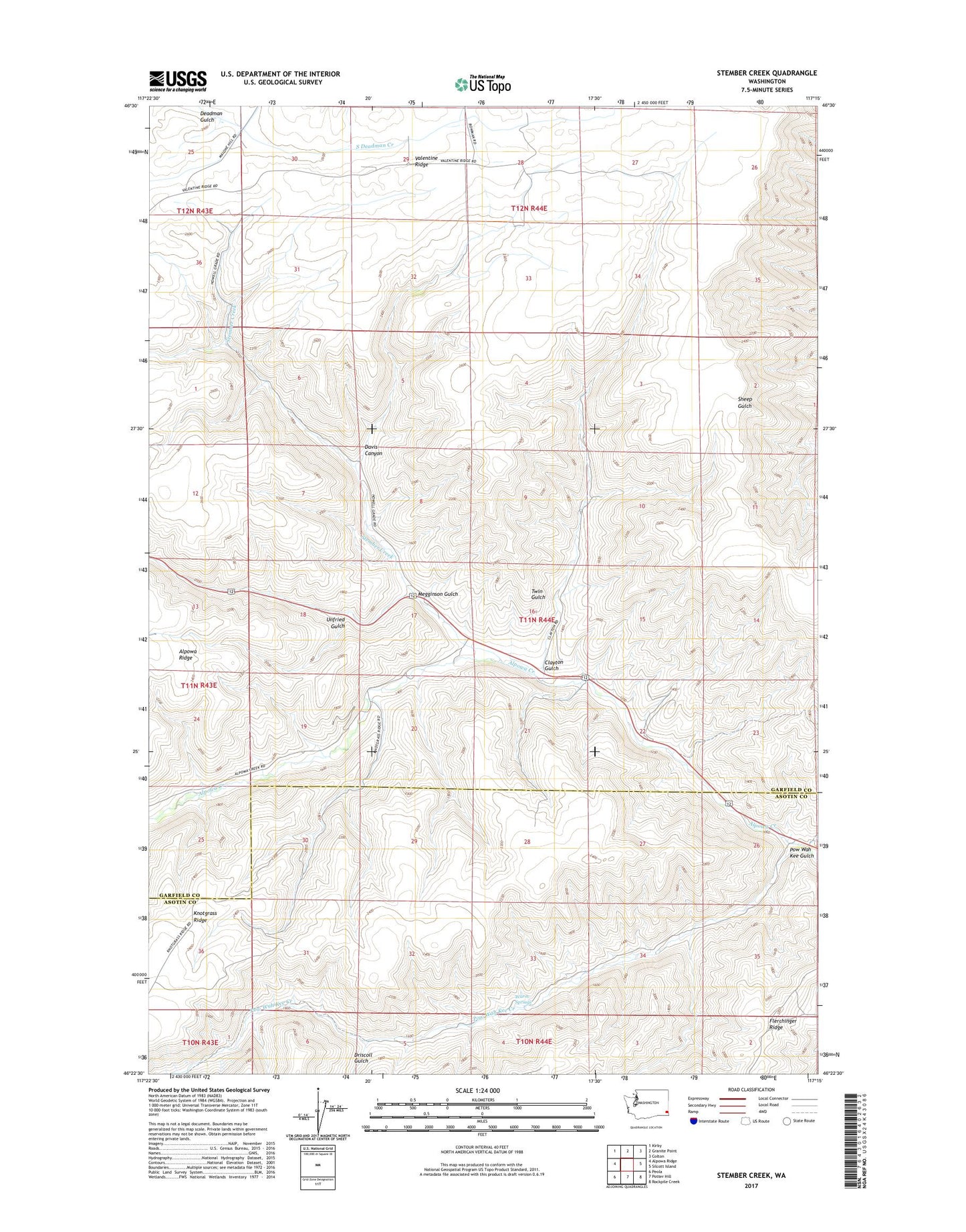
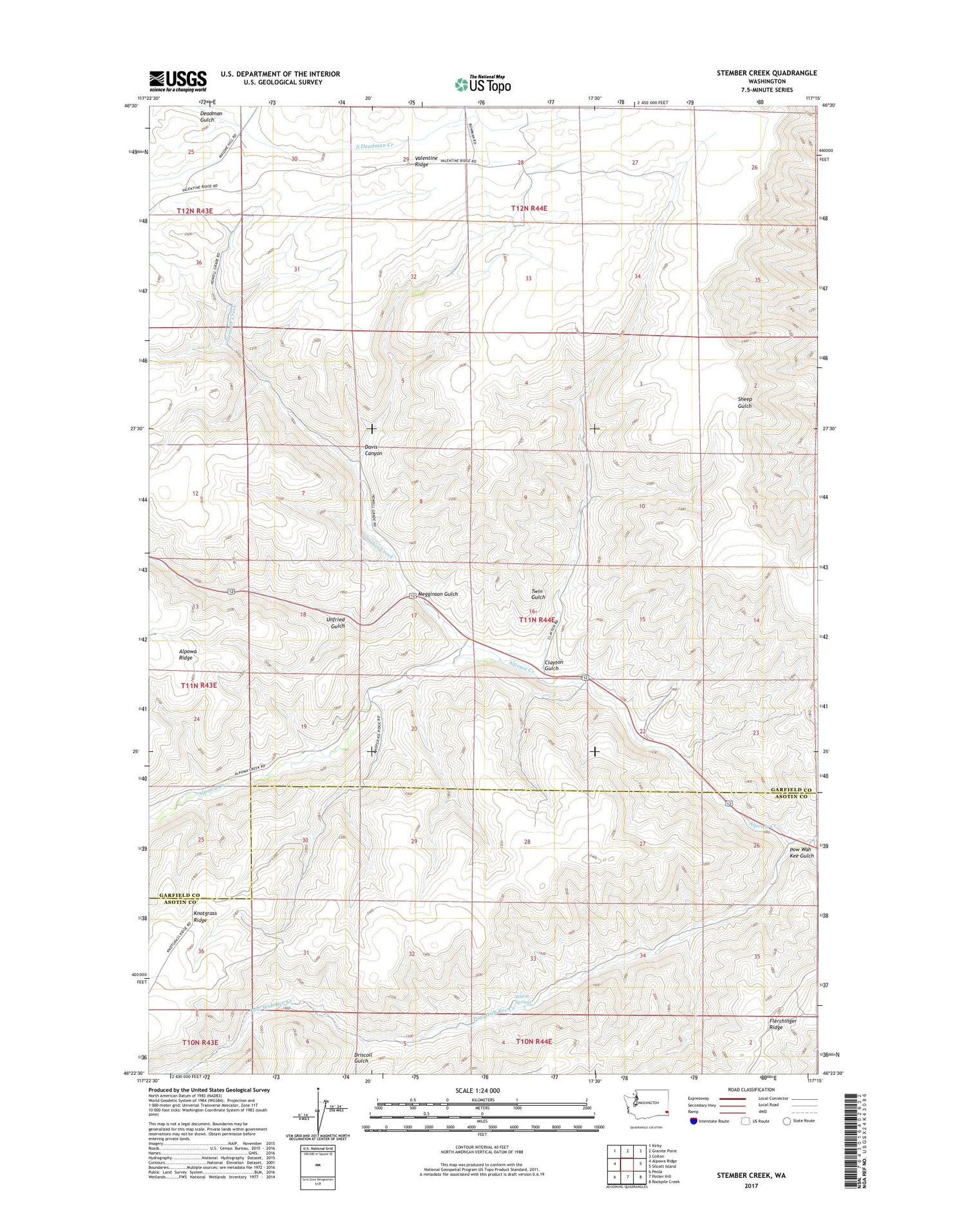
2020 topographic map quadrangle Stember Creek in the state of Washington. Scale: 1:24000. Based on the newly updated USGS 7.5' US Topo map series, this map is in the following counties: Garfield, Asotin. The map contains contour data, water features, and other items you are used to seeing on USGS maps, but also has updated roads and other features. This is the next generation of topographic maps. Printed on high-quality waterproof paper with UV fade-resistant inks.
Quads adjacent to this one:
West: Alpowa Ridge
Northwest: Kirby
North: Granite Point
Northeast: Colton
East: Silcott Island
Southeast: Rockpile Creek
South: Potter Hill
Southwest: Peola
Contains the following named places: Alpowa, Clayton Gulch, Davis Canyon, Driscoll Gulch, Megginson Gulch, Pow Wah Kee Creek, Pow Wah Kee Gulch, Stember Creek, Twin Gulch, Unfried, Unfried Gulch, Valentine, Valentine Ridge, Warm Springs