MyTopo
Pierce Draw Wyoming US Topo Map
Couldn't load pickup availability
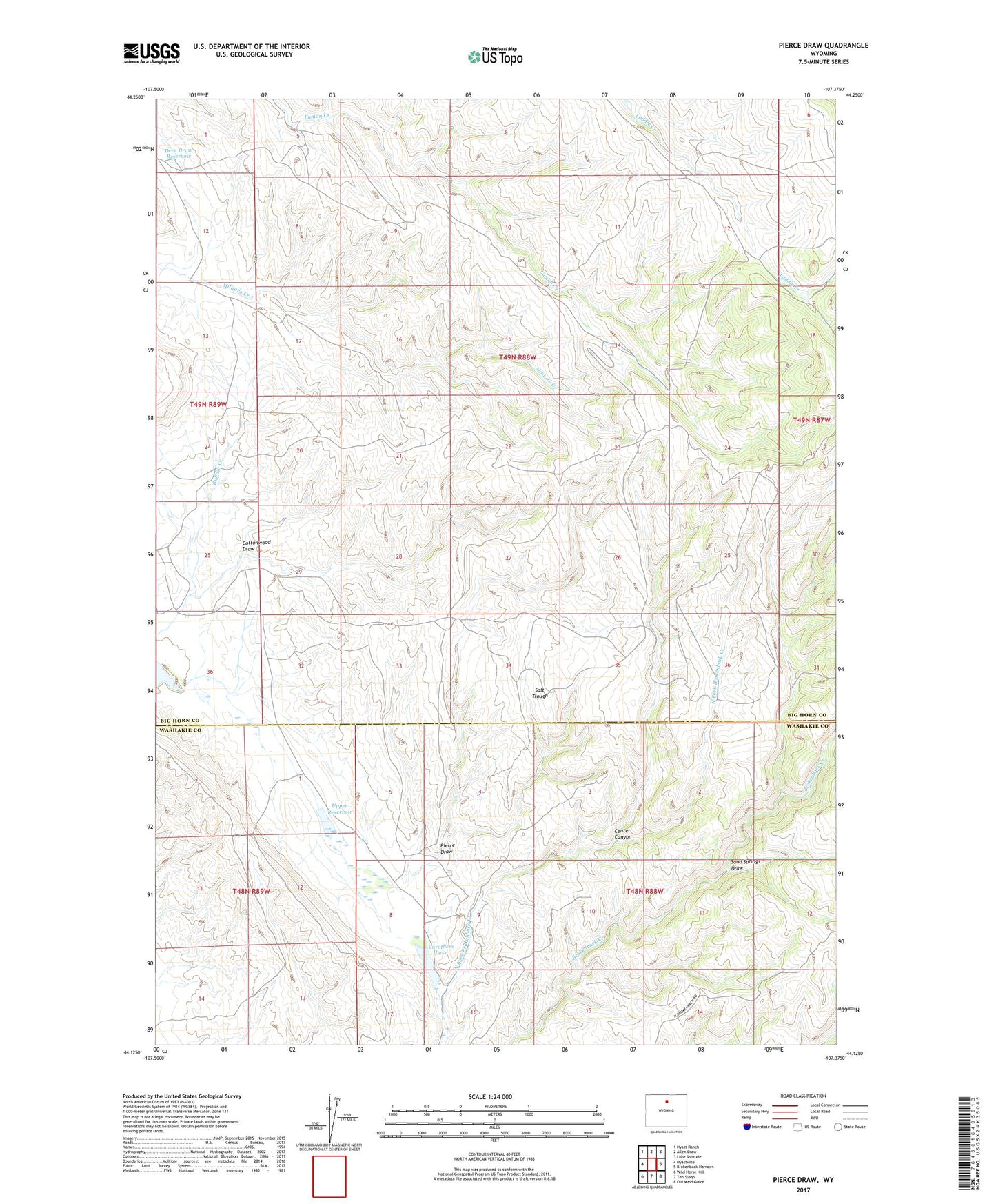
2021 topographic map quadrangle Pierce Draw in the state of Wyoming. Scale: 1:24000. Based on the newly updated USGS 7.5' US Topo map series, this map is in the following counties: Big Horn, Washakie. The map contains contour data, water features, and other items you are used to seeing on USGS maps, but also has updated roads and other features. This is the next generation of topographic maps. Printed on high-quality waterproof paper with UV fade-resistant inks.
Quads adjacent to this one:
West: Hyattville
Northwest: Hyatt Ranch
North: Allen Draw
Northeast: Lake Solitude
East: Brokenback Narrows
Southeast: Old Maid Gulch
South: Ten Sleep
Southwest: Wild Horse Hill
Contains the following named places: Brokenback Dam, Brokenback Reservoir, Carothers Lake, Center Canyon, Cottonwood Draw, Deer Draw Reservoir, Freddy Well, Pierce Draw, Renner Well, Sand Springs Draw, Upper Dam, Upper Reservoir