MyTopo
Guilford Connecticut US Topo Map
Couldn't load pickup availability
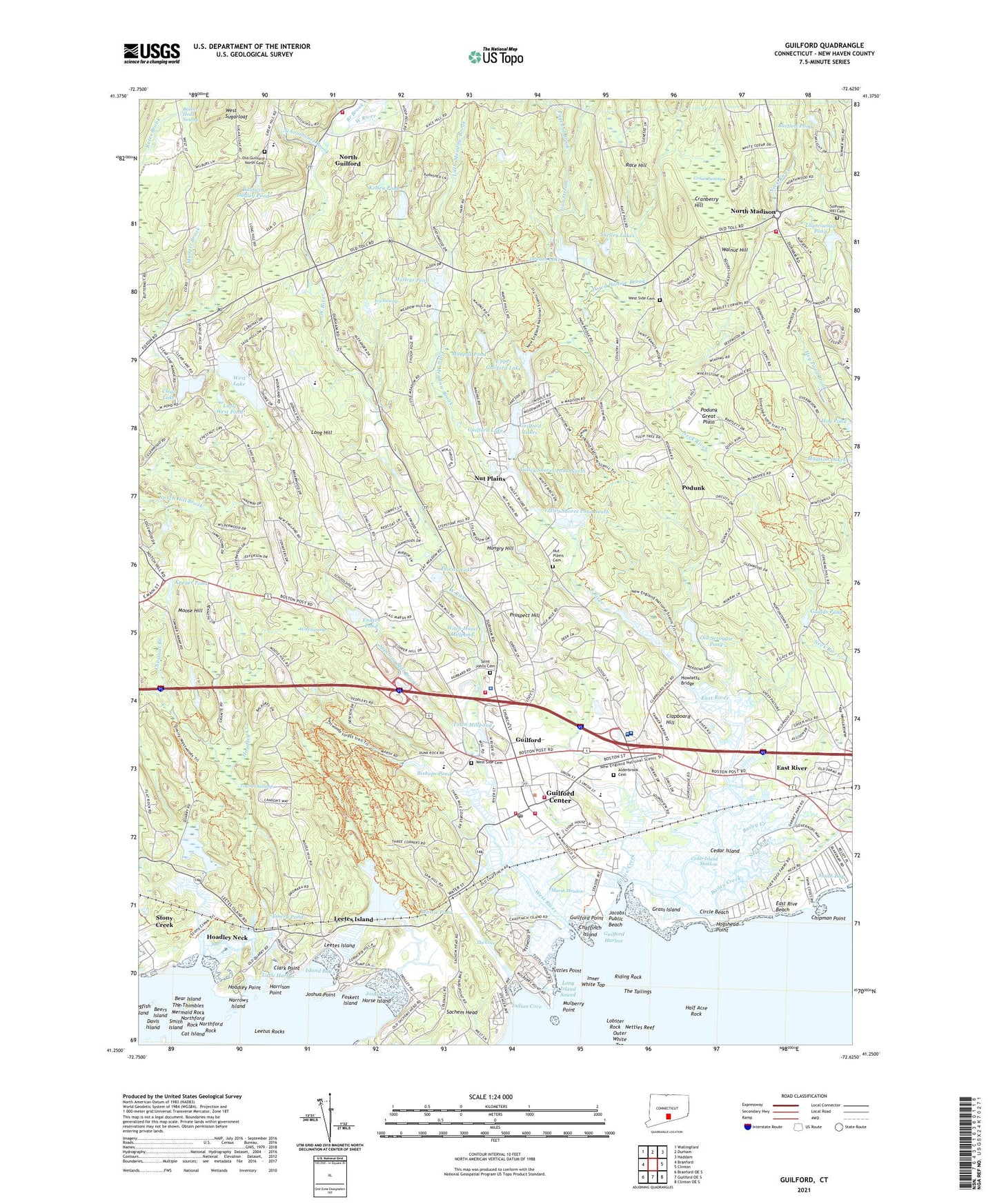
2024 topographic map quadrangle Guilford in the state of Connecticut. Scale: 1:24000. Based on the newly updated USGS 7.5' US Topo map series, this map is in the following counties: New Haven. The map contains contour data, water features, and other items you are used to seeing on USGS maps, but also has updated roads and other features. This is the next generation of topographic maps. Printed on high-quality waterproof paper with UV fade-resistant inks.
Quads adjacent to this one:
West: Branford
Northwest: Wallingford
North: Durham
Northeast: Haddam
East: Clinton
Southeast: Clinton OE S
South: Guilford OE S
Southwest: Branford OE S
This map covers the same area as the classic USGS quad with code o41072c6.
Contains the following named places: A Baldwin Middle School, A W Cox School, Acadia House, Alderbrook Cemetery, Bailey Creek, Baldwin Dudley Pond, Bear Island, Beattie Pond, Beers Island, Bethel Assembly of God Church, Bishops Pond, Bitner Park, Branch Brook, Calvin Leete School, Capello Pond, Cat Island, Cedar Island, Cedar Island Meadow, Cedar Swamp, Chaffinch Island, Chaffinch Island State Park, Chestnut Branch, Chipman Point, Chittenden Park, Christ Episcopal Church, Circle Beach, Clapboard Hill, Clark Point, Clear Lake, Cranberry Hill, Cut in Two Island, Davis Island, Doctor Robert H Brown School, Dogfish Island, Dowd Hollow Brook, Dream Lake, E C Adams Middle School, East Rive Beach, East River, East River Wildlife Area, Emery Pond, Enders Pond, First Baptist Church of Guilford, First Church of Christ Scientist, First Congregational Church, Foskett Island, Genesee Tunnel, Goulds Pond, Grass Island, Great Harbor Hunting Area, Great Harbor Wildlife Area, Guilford, Guilford Center Census Designated Place, Guilford Community Center, Guilford Fire Chief's Office, Guilford Fire Department Headquarters, Guilford Fire Department Station 1, Guilford Fire Department Station 2, Guilford Fire Department Station 3, Guilford Free Library, Guilford Harbor, Guilford High School, Guilford Historic Town Center, Guilford Lake, Guilford Lakes, Guilford Lakes Lower Dam, Guilford Lakes School, Guilford Lakes Upper Dam, Guilford Plaza Shopping Center, Guilford Point, Guilford Police Department, Guilford Post Office, Guilford Station, Guilford Town Boat Landing, Guilford Town Green, Half Acre Rock, Hall Lot Brook, Harrison Point, Hen Island, Henry Whitfield State Historical Museum, High Hill School, Hoadley Creek, Hoadley Neck, Hoadley Point, Hog Pond, Hogshead Point, Horse Island, Howletts Bridge, Hungry Hill, Hyland House Museum, Indian Cove, Inner White Top, Iron Stream, Island Bay, Ivy Swamp, Jacobs Public Beach, Jones School, Joshua Cove, Joshua Point, Kathleen H Ryerson School, Keley Pond, Kelsey Pond, Kelsey Pond Dam, Kneuer Pond, Laurelwood Pond, Laurelwood Pond Dam, Leetes Island, Leetes Island Quarry, Leetus Rocks, Little Harbor, Little Meadow Brook, Little West Pond, Lobster Rock, Long Hill, Malleys Pond, Marsh Meadow, Maupas Pond, Maupas Pond Dam, Meeting House Hill Historic District, Mermaid Rock, Moose Hill, Mulberry Point, Narrows Island, Netties Reef, North Guilford, North Guilford Congregational Church, North Guilford Volunteer Fire Company 4 and 5, North Madison, North Madison Shopping Center, North Madison Volunteer Fire Company, Northams House, Northford Rock, Nut Plains, Nut Plains Cemetery, Nut Plains Park, Old Guilford North Cemetery, Old Scroggie Pond, Old Stone House, Our Lady of Grace Monastery, Our Lady of Mercy School, Outer White Top, Page Lot Brook, Peddlers Park, Podunk, Podunk Great Plain, Prospect Hill, Race Hill, Riding Rock, Sabbathday House, Sachem Head, Saint George Catholic Church, Saint Johns Cemetery, Saint Johns Episcopal Church, Schoolhouse Brook, Shelley Lakes, Shoreline Day School, Sluice Creek, Smith Bay, Smith Island, Spinning Mill Brook, Stony Creek, Strawberry Hill Shopping Center, Sullivans Pits Septic Lagoons, Summer Hill Cemetery, The Country School, The Cove, The Guilford Handcraft Center, The Tailings, Thirsty Lake, Town Millpond, Town of Guilford, Town of Madison, Towner Swamp, Tuttles Point, Upper Guilford Lake, Valley Shores Pond North, Valley Shores Pond South, Vineyard Christian Fellowship Church, Walnut Hill, Wayland Island, West Lake, West River, West Side Cemetery, West Sugarloaf, West Woods Trail, Westwoods Plaza Shopping Center, Witch Hazel Millpond, Wolf Swamp, Yale - New Haven Shoreline Medical Center, ZIP Code: 06437


