MyTopo
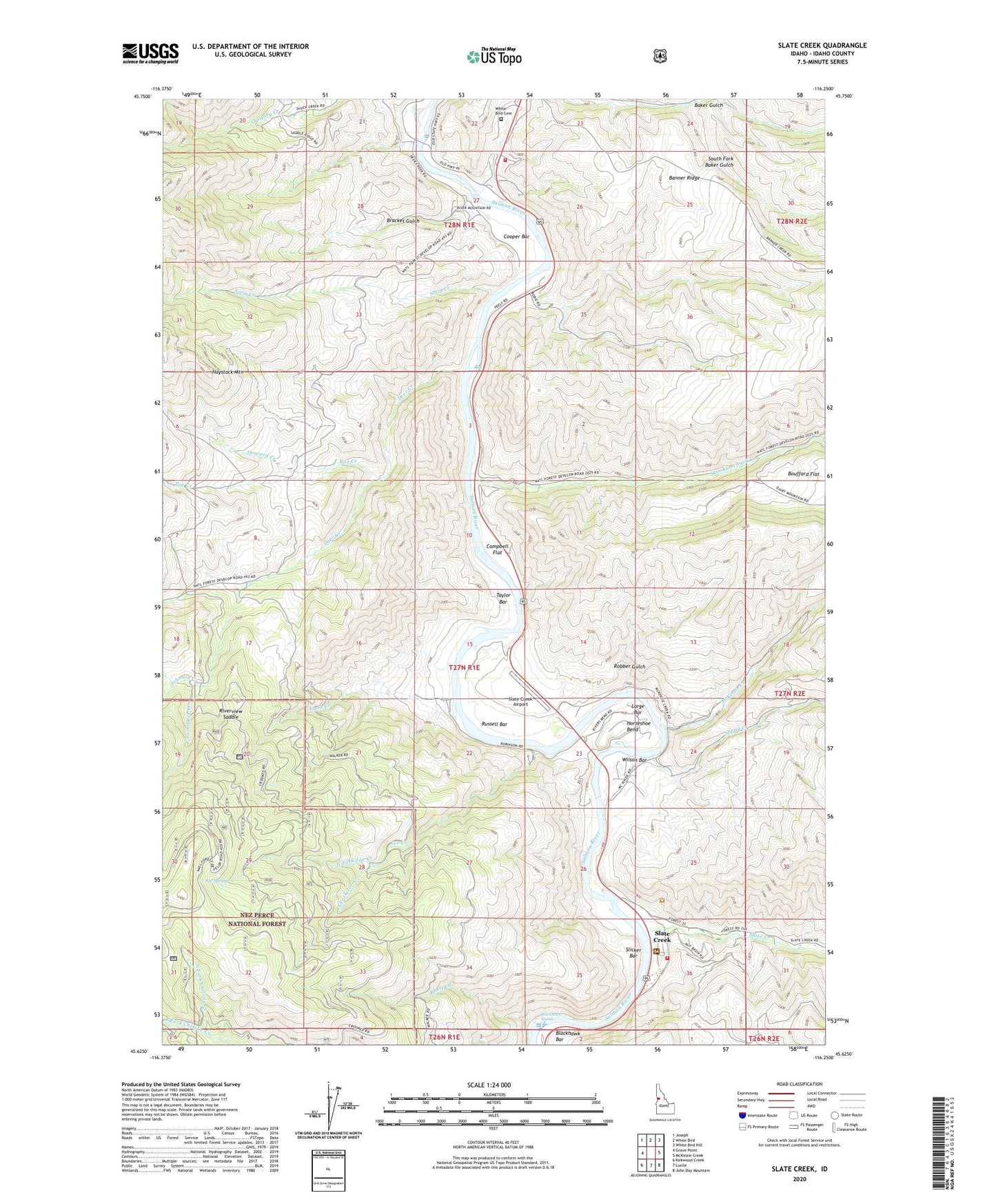
Slate Creek Idaho US Topo Map
Couldn't load pickup availability
Also explore the Slate Creek Forest Service Topo of this same quad for updated USFS data
2024 topographic map quadrangle Slate Creek in the state of Idaho. Scale: 1:24000. Based on the newly updated USGS 7.5' US Topo map series, this map is in the following counties: Idaho. The map contains contour data, water features, and other items you are used to seeing on USGS maps, but also has updated roads and other features. This is the next generation of topographic maps. Printed on high-quality waterproof paper with UV fade-resistant inks.
Quads adjacent to this one:
West: Grave Point
Northwest: Joseph
North: White Bird
Northeast: White Bird Hill
East: McKinzie Creek
Southeast: John Day Mountain
South: Lucile
Southwest: Kirkwood Creek
This map covers the same area as the classic USGS quad with code o45116f3.
Contains the following named places: Blackhawk Bar, Blackhawk Rapids, Bracket Gulch, Brown, Campbell Flat, Cooper Bar, Deer Creek, East Fork Deer Creek, Haystack Mountain, Horseshoe Bend, Howard Creek, Joe Creek, Joe Spring, Johnson Creek, Kilgore Orchard, Large Bar, Lyon Creek, McKinzie Creek, North Fork Christie Creek, North Fork Joe Creek, North Fork Skookumchuck Creek, Poe Creek, Rhett Creek, Riverview Saddle, Robber Gulch, Robinson, Rusell, Russell Bar, Salmon River Rural Fire Department, Salmon River Rural Fire District Station 6, Shuck Creek, Skookumchuck Campground, Skookumchuck Creek, Slate Creek, Slate Creek Airport, Slate Creek Cemetery, Slate Creek District Ranger Station, Slicker Bar, Slippy Creek, Sotin Creek, South Fork Baker Gulch, South Fork Christie Creek, South Fork Joe Creek, South Fork Skookumchuck Creek, Taylor Bar, Twin Bridges Access Area, White Bird Cemetery, Wilson, Wilson Bar, Zumwalt, ZIP Code: 83554